|
Gary Flynn ( KE8FD )
GPS Mapping |
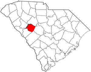
SALUDA COUNTY SC Cemetery GPS Mapping Project
|
Paul Kankula ( NN8NN )
Webmaster |
|
Gary Flynn ( KE8FD )
GPS Mapping |
SALUDA COUNTY SC Cemetery GPS Mapping Project
|
Paul Kankula ( NN8NN )
Webmaster |
|
Effective: 05/05/24 08:02 by: PMK |
USGS GEOGRAPHIC NAMES INFORMATION SYSTEM (GNIS) - POPULATED PLACES
https://geonames.usgs.gov/domestic/index.html
GOOGLE MAPS
|
POPULATED PLACES GNIS LINKS: Big Creek, Blacks, Bleases Crossroads, Celestia (historical), Chapmans Crossroads, Colemans Crossroads, Corinth (historical), Delmar, Denny, Ellis (historical), Emory, Eulala, Fruit Hill, Good Hope, Hibernia, Hickory Grove, Higgins, Holston Crossroads, Jones Crossroads, Lake Murray Shores, Limp, Merchant (historical), Mobleys Crossroads, Mount Willing, Owdoms, Richland, Ridge Spring, Saluda, Speigner, Traus (historical), Ward, Wyses Ferry |
It's very common for a cemetery to be known by several different names..!
If known, alternate names will be noted somewhere on the county's webpage listing.
Contact Gary Flynn at garyflynn44@yahoo.com, if all you know, is your cemetery's general area.
Cemetery names will normally be listed in alphabetical order. Ex: Brown-Jones-Wilson Families
Surnames will normally come before given names. Ex: Brown Family, John
Plantation names were not ordinarily shown on the Census. Using plantation names to locate ancestors can be difficult because the name of a plantation may have been changed through the years and because the sizeable number of large farms must have resulted in lots of duplication of plantation names.
Plantation nicknames names, if known, will normally be listed as aka (also known as).
It's assumed that if a plantation had over 100 enslaved workers, that there would have normally been a separate cemetery for them. Often landowner's family graves might be located nearby, but always kept separate.
Plantation homes were often burned after slave emancipation, because the landowner could no longer afford to pay their land taxes.
Historical home locations can normally be determined by locating their existing foundations.
|
Saluda County Historical Society Cemetery Survey Book Surnames Submitted by:
The following Surname Indexes WILL NOT provide you with an Individual's Date-of-Birth/Death. It will onlytell you in what Cemetery Survey Book, your Surname can be found in and on what page number.
Book 1 = Our Saluda County Ancestors, Volume 1
Book 2 = Our Saluda County Ancestors, Volume 2
Book 3 = Our Saluda County Ancestors, Volume 3
|
|
Book 1 |
||||
|
Book 2 |
||||
|
Book 3 |
|
|
Cemetery Survey Book Surname Indexes Submitted by:
The following Surname Indexes WILL NOT provide you with an Individual's Date-of-Birth/Death. It will onlytell you in what Cemetery Survey Book, your Surname can be found in and on what page number.
Book 1 = Unknown Book Publisher
Book 2 = Unknown Book Publisher
Book 3 = Unknown Book Publisher
|
|
Newberry County Historical Society Cemetery Survey Book Surname Indexes Submitted by:
The following Surname Indexes WILL NOT provide you with an Individual's Date-of-Birth/Death. It will only tell you in what Cemetery Survey Book, your Surname can be found in and on what page number.
Book 1 = Newberry County Cemeteries, vol. 2, 1985, 106 cemeteries in Newberry County, 11 cemeteries in Laurens County bordering Newberry, 7 cemeteries in Saluda County bordering on Newberry and 10 cemeteries in Lexington County bordering on Newberry, 258 pgs + index.
|
|
Book 1 |
Index | A - | - Z |
|
Family History Library - Books The Church of Jesus Christ of Latter-Day Saints
|
Research Notes:
Saluda County was named for the Saluda River, which formaps one of its borders. The county was established in 1895 from part of Edgefield County, and the county seat is the town of Saluda. The Cherokee Indians lived in this area for many years. In 1755 they signed a treaty with the British at their settlement, known as Saluda Old Town. Scotch-Irish and English settlers subsequently began moving into the area, while the Cherokees moved farther to the north. Two famous heroes of the Alamo, William Barrett Travis (1809-1836) and James Butler Bonham (1807-1836) were natives of what is now Saluda County. (Submitted by: SC State Library / Mary Morgan, 31-Mar-2008)
(1) = Some family cemetery names might only represent a plot (gathering) of family graves,
that are located within a different name & larger cemetery.
(2) = Text File used for miscellaneous information.
(3) = Saluda County Find-a-Grave Project
(4) = Survey Book Code # = County # - Survey Book # - Page #
AME = African Methodist Episcopal (N) SMC = Southern Methodist Church UMC = United Methodist Church ME = Methodist Episcopal
Zion AME = Zion African Methodist Episcopal (N) CME = Christian Methodist Episcopal (N) = Negro (S) = Slave (C) = Caucasian (I) = Indian (A) = Asian
|
Ref # |
Cemetery Name (1) |
GPS Mapping |
Aerial View |
Road Map |
Photos |
Text (2) |
Find a Grave (3) |
Survey Book (4) |
Location |
|
41-277 |
Abney Family (Slaves) (N) |
Can't locate cemetery |
41-B03-P018 |
||||||
|
41-001 |
Abney Family |
n34 09.200 , w81 44.910 |
Crossroad Church Rd, west of Rt 121 |
||||||
|
41-002 |
Abney Family, Joel |
n34 10.100 , w81 43.940 |
F |
41-B03-P020 |
east of Rt 121, north of Old Cherokee Rd |
||||
|
41-003 |
Abney Family, Nathaniel |
n34 10.410 , w81 44.300 |
F |
41-B03-P018 |
west of Rt 121, south of Saluda River |
||||
|
41-004 |
Abney Family, Zachariah |
n34 10.025 , w81 43.171 |
F |
41-B03-P019 |
east of Rt 121, on Tosti Creek Rd |
||||
|
41-005 |
Adams Family |
can't locate cemetery |
41-B01-P001 |
||||||
|
41-006 |
Adams-Morris Family |
can't locate cemetery | F |
41-B03-P021 |
|||||
|
41-007 |
Allen Family |
can't locate cemetery | F |
41-B01-P001 |
Fruit Hill Section of Saluda Co. |
||||
|
41-008 |
Amick Grove Pentecostal Holiness |
n33 57.333 , w81 38.283 |
F |
41-B01-P123 |
US 178 |
||||
|
41-009 |
Asbill Family |
n33 53.217 , w81 37.400 |
F |
41-B01-002 |
near Ridge Spring-Monetta High School |
||||
|
41-010 |
Attaway #1 |
can't locate cemetery |
41-B03-P022? |
aka Morse,
Lockhart Church Rd |
|||||
|
41-011 |
Attaway #2 |
can't locate cemetery | F |
41-B01-002 |
near Trinity Lutheran Church |
||||
| 41-301 | Bange Family | 33.89905, -81.74960 | A | M | F | ||||
|
41-012 |
Bartley Family |
n33 50.833 , w81 46.583 |
F |
Rt 23, west of Pond Dam Rd |
|||||
| 41-302 | Barnes Family | can't locate cemetery | F | Saluda | |||||
| 41-303 | Bartley Family | n33 50.833 , w81 46.583 | A | M | F | n of sr-23, w of pond dam rd, johnson | |||
|
41-013 |
Bates Family #1 |
n33 53.817 , w81 34.200 |
F |
41-B01-003? |
Sandy Ln, south of Rt 23 |
||||
|
41-014 |
Bates Family #2 |
n33 54.650 , w81 33.583 |
F |
41-B01-003? |
Bermuda St,off US178 |
||||
|
41-015 |
Bell Family |
can't locate cemetery |
41-B01-005 |
near Ward, SC |
|||||
| 41-304 | Bennetts Family | can't locate cemetery | F | 434 Fairfox Road, Chappells | |||||
|
41-016 |
Bethany UMC Methodist |
n34 07.217 , w81 41.533 |
F |
41-B03-P024 |
Bethany Rd & Hightower Rd |
||||
|
41-018 |
Bethel Baptist |
n33 51.567 , w81 36.050 |
F |
41-B01-P126 |
Rt 23 |
||||
|
41-019 |
Bethel Pentecostal Holiness |
n34 02.567 , w81 30.600 |
F |
Bethel Church Rd, east of Delmar Rd |
|||||
|
41-020 |
Bethel Universalist |
n34 07.083 , w81 47.783 |
F |
41-B02-P001 |
41-68, east of Pineywood Rd |
||||
|
41-278 |
Bethel Pentecostal Holiness |
can't locate cemetery |
41-B02-P002 |
||||||
|
41-022 |
Bethlehem Baptist |
n34 02.850 , w81 40.183 |
F |
41-B03-P074 |
Quenny Rd, off of Dailey Creek Rd |
||||
|
41-021 |
Bethlehem UMC Methodist |
n33 54.133 , w81 49.083 |
F |
41-B03-P045 |
Bethlehem Church Rd, west of Rt 121 |
||||
|
41-023 |
Beulah Baptist |
n33 58.717 , w81 34.067 |
F |
41-B02-P004 |
Beulah Rd, north of W Creek Rd |
||||
|
41-024 |
Bible Way Church of Saluda |
n33 55.122 , w81 50.361 |
F |
41-B02-P004 |
41-21 (Fruit Hill Rd) & Pencreek Rd |
||||
|
41-025 |
Black Family |
n33 54.684 , w81 43.673 |
41-B03-P067? |
Speigner Rd, northeast of Old Charleston Rd |
|||||
|
41-026 |
Bledsoe Family |
n33 59.693 , w81 54.622 |
41-B03-P023 |
off Running Wild Rd, west of US 378 |
|||||
|
41-027 |
Bodie Family |
n33 57.667 , w81 36.100 |
north of Lockett Rd |
||||||
|
41-028 |
Bodie, Nathan |
n33 54.214 , w81 41.259 |
F |
41-B03-P068 |
east of Spann Rd, near Good Hope School Rd |
||||
| 41-305 | Bonham-Smith Family | n34 00.664 , w81 41.520 | A | M | F | 000' e of boyd branch rd & wightman rd, Saluda | |||
|
41-029 |
Boozer Hill Church |
n34 02.150 , w81 36.767 |
F |
Hollywood Rd, north of Cold Spring Rd |
|||||
|
41-030 |
Borroum Family |
can't locate cemetery |
41-B03-P070 |
Little Saluda River & Indian Creek |
|||||
|
41-031 |
Bouknight-Merchant Family |
n34 08.017 , w81 38.683 |
F |
41-B01-P005 |
east of Rt 395, north of The Ridge Rd |
||||
|
41-032 |
Bouknight Family, Daniel |
n33 57.867 , w81 34.250 |
F |
41-B03-P071 |
Beulah Rd, south of W. Creek Rd |
||||
|
41-033 |
Bouknight Family, Samuel |
n33 56.867 , w81 33.767 |
F |
41-B03-P072 |
east of Beulah Rd, on Woods Rd (Judge Long Rd) |
||||
|
41-034 |
Branch Hill AME Methodist (N) |
n34 08.350 , w81 50.400 |
F |
Branch Hill Rd, off Rt 39 |
|||||
|
41-035 |
Brooks Family |
n34 06.036 , w81 39.403 |
41-B03-P069 |
R 194, near Fred Goff Rd |
|||||
|
41-036 |
Bryan Family |
can't locate cemetery |
41-B01-P008 |
6 miles from Saluda, south of US 378 |
|||||
|
41-037 |
Buffington Family |
can't locate cemetery |
41-B01-P005 |
||||||
|
41-038 |
Burton Family |
n33 52.067 , w81 36.867 |
F |
41-B01-P005 |
Burton Rd, east of Padgett Pond Rd |
||||
| 41-279 | Butler Family, (old) | can't locate cemetery | Deep in the woods, off Old Charleston Rd | ||||||
|
41-039 |
Butler Family, Henry |
n34 04.992 , w81 52.604 |
F |
41-B03-P069 |
Fairfax Rd, west of Rt 702 |
||||
|
41-040 |
Butler UMC Methodist |
n34 03.883 , w81 43.667 |
41-B01-P008? 41-B01-P127 |
Butler Church Rd |
|||||
|
41-041 |
Buzzard Family |
n34 01.017 , w81 34.517 |
41-B01-P010 |
aka Mission Church,
41-424 |
|||||
| 41-306 | Calvary Holiness Tabernacle | n34 02.273 , w81 51.412 | A | M | F | s of us-178, e of white acre rd, Saluda | |||
|
41-042 |
Cannon Family |
can't locate cemetery |
41-b01-P010 |
||||||
|
41-043 |
Carver Family |
n33 56.367 , w81 40.017 |
F |
Sardis Rd, north of Little Country Rd |
|||||
|
41-044 |
Cato-Holstein Family |
can't locate cemetery |
41-B03-P078 |
see Holstein |
|||||
|
41-045 |
Caugham Family |
n34 04.832 , w81 32.836 |
41-B03-P073 |
deadend Rd, off Georgia Rd |
|||||
|
41-046 |
Cedar Grove Lutheran |
n33 56.650 , w81 46.350 |
F |
41-B02-P005 |
Forest Hills Rd & Dozier Rd |
||||
| 41-307 | Chapman Family | can't locate cemetery | F | 197 Dave Road Saluda | |||||
|
41-047 |
Chestnut Hill Baptist |
n34 07.250 , w81 50.417 |
F |
41-B01-P140 |
41-135 (Chestnut Hill Rd), west of Rt 39 |
||||
|
41-048 |
Clark Family |
Can't locate cemetery |
41-B01-P011 |
||||||
|
41-049 |
Clyde's Chapel Southern Methodist |
n33 58.017 , w81 37.850 |
F |
41-B02-P006 |
aka Bedenbaugh
41-25 (Spann Rd), north of Woodhall Rd |
||||
|
41-050 |
Coleman Family, Edward |
can't locate cemetery | F |
41-B03-P077 |
|||||
|
41-051 |
Coleman Family, Ida C. |
can't locate cemetery | F |
41-B01-P011 |
|||||
|
41-052 |
Coleman Family, Nannie |
can't locate cemetery | F |
41-B03-P077 |
Andrew Colemen Rd |
||||
|
41-053 |
Coleman Family, Patrick |
can't locate cemetery |
41-B01-P012 |
||||||
|
41-054 |
Coleman Family, Thornton |
can't locate cemetery |
41-B01-P013 |
||||||
|
41-055 |
Corinth Lutheran Church |
n34 06.300 , w81 37.583 |
F |
41-B02-P013 |
on 41-90, north of Rt 194 |
||||
|
41-280 |
Corley Family |
n34 01.269 , w81 38.818 |
41-B03-P079 |
aka Sardis Baptist New Cemetery (deeded to) n & across from Sardis Baptist, per melindakf@msn.com |
|||||
|
41-056 |
Corley Family |
n33 53.967 , w81 36.917 |
41-B01-P014? |
Wood Valley Rd |
|||||
|
41-057 |
Corley Family, Catlett |
n34 01.626 , w81 39.023 |
F |
41-B03-P080 |
Sardis Rd, first house on left, off Mt. Willing Rd |
||||
|
41-242 |
Corley Family, George |
n34 02.208 , w81 38.709 |
F |
Wallace Rd, near Mitchell Rd |
|||||
|
41-058 |
Corley Family, William |
n34 01.382 , w81 33.537 |
F |
41-B01-P014? |
s/a Unknown #15, Near Corley Bridge, Delmar |
||||
|
41-111 |
Corley-Jennings Family |
can't locate cemetery | F |
41-B01-P030 |
off Mt. Willing Rd, south of US 378 |
||||
|
41-059 |
County Memorial, Saluda |
n33 56.467 , w81 41.300 |
F |
aka Saluda County Memorial,
Richland Creek Rd |
|||||
|
41-060 |
Cross Road AME Methodist (N) |
n34 09.117 , w81 44.583 |
F |
41-B01-P147 |
Crossroad Church Rd, west of Rt 121 |
||||
|
41-061 |
Crouch Family |
n33 58.397 , w81 39.810 |
F |
41-B01-P015 |
41-29 (Duncan Rd, south of US 178) |
||||
|
41-062 |
Crout Family |
n34 03.980 , w81 30.585 |
F |
41-B01-P016 |
Atlas Dr, south of Prices Bridge Rd, Lake Murray Shores |
||||
|
41-063 |
Culpepper-Sheppard-Strother Family |
can't locate cemetery | F |
41-B01-P016 |
|||||
|
41-064 |
Cyrus Family |
can't locate cemetery | F | ||||||
| 41-308 | Dean Family | n34 00.787 , w81 56.816 | A | M | F | 2000' w of loop de loops rd, sumter national forrest | |||
|
41-065 |
Deans Chapel Pentecostal Holiness |
n34 06.681 , w81 42.104 |
F |
41-B03-P143 |
Hollywood Rd, west of Bethany Rd |
||||
|
41-066 |
DeLoache Family #1 |
can't locate cemetery |
41-B01-P016? |
north of US 378, 3 miles from Saluda |
|||||
|
41-067 |
DeLoache Family #2 |
can't locate cemetery |
41-B01-P017? |
Old Chappell Ferry Rd, near mile Marker #43 |
|||||
|
41-068 |
Denny Family |
n33 53.214 , w81 42.741 |
41-B03-P082 |
Old Charleston Rd, east of Spann Rd |
|||||
|
41-281 |
Dorn Family |
n34 00.244 , w81 57.115 | A | M | F |
41-B03-P084 |
3000' s of little mountain rd, saluda | ||
|
41-069 |
Dozier Family |
can't locate cemetery |
41-B01-018 |
north of US 378, 4 miles east of Saluda |
|||||
|
41-070 |
Dry Creek Baptist |
n33 51.683 , w81 45.933 |
F |
41-B02-P024 |
on 41-45 (Hallman Rd), one mile west of Rt 193 |
||||
|
41-071 |
Edwards Family #1 |
34.01123, -81.67174 |
A | M | F |
41-B01-P019 |
west of Dailey Creek Rd, south of US 378 |
||
|
41-072 |
Edwards Family #2 |
can't locate cemetery | F |
41-B01-P019 |
off Duncan Rd (41-29), west of Rt 39 |
||||
|
41-073 |
Ellis Family |
can't locate cemetery | F |
41-B03-P086 |
Hollywood School Rd, behind Ellis home, Saluda |
||||
|
41-074 |
Emory UMC Methodist |
n33 59.200 , w81 42.367 |
F |
41-B02-P029 |
Forrest Hills Rd & Emory Rd |
||||
|
41-075 |
Etheredge Family |
n33 59.600 , w81 32.483 |
F |
41-B03-P087 |
Beulah Rd, east of Jerimiah Rd |
||||
|
41-076 |
Faith Temple Holiness |
n34 04.317 , w81 51.283 |
F |
41-B01-P148 |
Rt 702 |
||||
|
41-077 |
Ferguson Family, Forrest |
n34 03.921 , w81 42.818 |
41-B01-P019 |
corner of Denny Hwy & Big Creek Rd |
|||||
|
41-105 |
Ferry Family, Holly |
n34 04.623 , w81 29.147 |
41-B03-P095 |
near end of Holly Ferry Rd |
|||||
|
41-078 |
Flat Rock |
n33 49.683 , w81 39.767 |
F |
west of Rt 392, north of County Line |
|||||
|
41-079 |
Forrest Family |
n33 55.789 , w81 44.728 |
41-B01-020 |
s/a Unknown #7,east of 41-258 |
|||||
|
41-080 |
Forrest Family, Thomas J. |
n33 55.540 , w81 41.497 |
41-B03-P088 |
Artemus Rd |
|||||
|
41-081 |
Forrest Family, William R. |
can't locate cemetery |
41-B03-P089 |
off of Rt 193 |
|||||
|
41-082 |
Foulk Family |
n33 57.217 , w81 34.583 |
F |
east of Beulah Rd, north of Old Golf Course Rd |
|||||
|
41-083 |
Fouts Family |
n33 57.817 , w81 34.983 |
F |
Double Bridges Rd. |
|||||
|
41-282 |
Fulmer Family, Eberhart |
can't locate cemetery |
41-B01-P022 |
||||||
|
41-084 |
Gassaway UMC Methodist (new) |
n33 59.367 , w81 50.133 |
F |
41-B01-P151 |
US 378 & Old Charleston Rd, Saluda |
||||
|
41-085 |
Gassaway UMC Methodist (old) |
n33 59.083 , w81 49.883 |
F |
41-B01-P149 |
Old Gassaway Rd, south of Old Charleston Rd, Saluda |
||||
|
41-086 |
Gibson Family, John |
n34 01.690 , w81 35.580 |
41-B03-P090 |
south of US 378, near High Point Rd ?? |
|||||
|
41-087 |
Gibson Family, William |
can't locate cemetery |
41-B03-P091 |
Hollywood School Rd, near Deans Chapel |
|||||
|
41-088 |
Goff Cemetery |
n33 59.075 , w81 35.056 |
Double Bridges Rd. |
||||||
|
41-089 |
Good Hope Baptist |
n34 02.167 , w81 53.517 |
F |
41-B02-P053 |
US 178 at Good Hope |
||||
|
41-090 |
Good Hope Lutheran (new) |
n33 54.533 , w81 41.200 |
F |
41-B01-P154? |
Spann Rd |
||||
|
41-283 |
Good Hope Lutheran (old) |
can't locate cemetery |
41-B01-P155? |
||||||
|
41-091 |
Gosset Family |
n33 56.633 , w81 36.283 |
F |
Enlow Rd, west of Old Golf Course rd |
|||||
|
41-092 |
Graham Family |
can't locate cemetery |
41-B01-P023 |
||||||
|
41-093 |
Griffith Family |
n34 05.380 , w81 46.750 |
F |
41-B01-P023 |
|||||
|
41-094 |
Griffith-Cromley Family |
can't locate cemetery | F |
41-B01-P024 |
|||||
|
41-095 |
Haltiwanger Family |
can't locate cemetery |
41-B01-P024 |
in woods behind Trinity Lutheran Church. |
|||||
|
41-096 |
Hardy Family #1 |
n34 02.978 , w81 37.865 | A | M | F |
41-B01-P024 |
Hardy Cemetery Rd |
||
|
41-097 |
Hardy Family #2 |
n34 02.812 , w81 37.738 | A | M |
41-B01-P024 |
near Hardy #1 |
|||
|
41-098 |
Harris Family |
n33 57.350 , w81 38.200 |
F |
41-B01-P025 |
Spann Rd, just north of US 178 |
||||
| 41-309 | Hart Springs Baptist | n33 53.779 , w81 40.908 | A | M | F | hart springs rd, n of neighbors rd, Ward | |||
|
41-100 |
Havird-Livingston Family |
n34 07.340 , w81 39.788 |
F |
41-B01-P026 |
corner of Old Cherokee Trail & The Ridge Rd |
||||
|
41-101 |
Havird Family, Zebulon |
n34 04.405 , w81 39.080 |
F |
41-B03-P093 |
Hunters Ln & Walnut Neck Rd |
||||
| 41-310 | Herlong Family | can't locate cemetery | F | Denny | |||||
|
41-102 |
Hickory Grove Advent Christian |
n34 05.000 , w81 44.567 |
F |
41-B02-P085 |
Hickory Grove Rd, east of Rt 121 |
||||
|
41-103 |
Hill Family |
n33 59.000 , w81 50.033 |
F |
41-B01-P027 |
Old Gassaway Rd, west of Old Charleston Rd |
||||
|
41-104 |
Hite Family |
n33 53.925 , w81 33.807 |
F |
41-B03-P094 |
Russell St, off Rt 23, Batesburg |
||||
| 41-311 | Holley Family | n34 04.646 , w81 29.127 | A | M | F | end of sunny point rd, n of holley ferry rd, Leesville | |||
|
41-106 |
Holstein Family |
n33 52.183 , w81 37.717 |
F |
off Padgett Pond Rd, south of Camp Rd |
|||||
|
41-107 |
Holston-Wise Family |
n33 55.800 , w81 35.100 |
F |
41-B01-P027 |
Beulah Rd, north of US 178 |
||||
|
41-108 |
Hopewell Congregational Holiness |
n34 03.800 , w81 50.983 |
F |
41-B02-P089 |
Old Chappells Ferry Rd, south of Rt 702 |
||||
|
41-109 |
Huiet Family |
34.08055, -81.69159 |
A | M | F |
41-B01-P028 |
Richland | ||
| 41-312 | Hurt Family | can't locate cemetery | |||||||
|
41-284 |
Indian |
can't locate cemetery |
41-B01-029 |
||||||
|
41-110 |
Jennings Family |
can't locate cemetery |
41-B01-P030 |
off Hollywood Rd, .5 mile north of US 378 |
|||||
|
41-285 |
J.C.B. ? |
can't locate cemetery |
41-B01-P053 |
||||||
|
41-112 |
Johnson Family #1 |
can't locate cemetery |
41-B01-P030? |
Rd 558B, Faulkner Mountain |
|||||
|
41-113 |
Johnson Family #2 |
n33 57.017 , w81 41.800 |
F |
41-B01-P030? |
Richland Creek Rd, east of Duncan Rd |
||||
|
41-114 |
Jones Family #1 |
n33 50.983 , w81 40.650 |
F |
41-B01-P031? |
Rt 39, Ridge Springs |
||||
|
41-115 |
Jones Family #2 |
n33 50.900 , w81 46.150 |
F |
41-B01-P031? |
Rt 23, west of Duncan Rd, Ward |
||||
|
41-017 |
Kingdom Hall of Jehovah's Witnesses |
n33 54.154 , w81 34.041 |
F |
Per W4TSS |
|||||
|
41-116 |
Lark Family |
n33 55.508 , w81 45.662 |
41-B03-P097 |
Old Charleston Rd, west of Duncan Rd |
|||||
| 41-313 | Little Angels Memorial Park | n34 00.616 , w81 44.894 | A | M | F | n of us-378, e of roseland dr, Saluda | |||
|
41-117 |
Lockhart Baptist |
n33 59.733 , w81 51.067 |
F |
41-B02-P091 |
Old Chap Ferry Rd, north of US 378 |
||||
|
41-118 |
Logan Family |
can't locate cemetery |
41-B01-P032 |
near Red Bank Creek |
|||||
|
41-119 |
Long Family |
can't locate cemetery | F |
41-B03-P096 |
Saluda | ||||
|
41-120 |
Lorick Family |
can't locate cemetery |
41-B03-P097 |
Old Bauknight Ferry Rd |
|||||
|
41-121 |
Lott Family |
n33 54.717 , w81 36.133 |
F |
Topaz Rd, south of Church Rd |
|||||
|
41-122 |
Lockett Church, Lucy |
n33 57.150 , w81 36.233 |
Lockett Rd, north of Old Golf Course Rd |
||||||
|
41-123 |
Mack Family, George A. |
can't locate cemetery |
41-B03-P098 |
||||||
|
41-226 |
Mack-Trotter Family |
n34 04.301 , w81 48.180 |
41-B03-P135 |
south of Tal Clary Rd, east of Ebb Mack Rd |
|||||
|
41-286 |
Maffett Family |
can't locate cemetery |
41-B01-P033 |
||||||
|
41-124 |
Matthews Family, Cleaves |
n34 00.517 , w81 36.517 |
F |
41-B03-P099 |
Cleve Cemetery Rd |
||||
|
41-125 |
Matthews Family, Furman |
n34 00.300 , w81 38.017 |
F |
41-B03-P108 |
Patch Work Rd |
||||
|
41-126 |
Matthews Family, Lewis C. |
n34 03.542 , w81 37.712 |
F |
41-B03-P118 |
Laidback Ln, off Hollywood Rd |
||||
|
41-127 |
Matthews Family, William G. |
n34 00.200 , w81 36.950 |
F |
41-B03-P114 |
Double Bridges Rd. |
||||
|
41-128 |
May Family |
can't locate cemetery |
41-B01-P033 |
||||||
|
41-129 |
Mayson Memorial |
n34 02.111 , w81 53.578 |
A | M | F | across from good hope baptist | |||
|
41-130 |
McCarty Family |
n34 05.929 , w81 39.245 |
41-B01-P034 41-B03-P119 |
near Salem Baptist Church |
|||||
|
41-131 |
McGee Family |
n33 56.150 , w81 39.600 |
F |
McGee Rd, south of Little Country Rd |
|||||
| 41-314 | Merchant Suddath | n34 07.474 , w81 38.844 | A | M | F | 600' e of rt-395, s of ridge rd, Denny | |||
|
41-133 |
Mill Town Memorial (N) |
n33 51.833 , w81 39.100 |
F |
41-B03-P120 |
Pecan Grove Rd, north of Murphy Farm Rd |
||||
|
41-134 |
Mine Creek Baptist (N) |
n33 54.567 , w81 48.800 |
F |
41-B01-P164 |
Rt 121 |
||||
|
41-287 |
Mitchell Family #1 |
can't locate cemetery |
41-B03-P121 |
||||||
|
41-135 |
Mitchell Family #2 |
n33 59.367 , w81 34.933 |
41-B01-P036? |
Double Bridges Rd,east of Spann Rd |
|||||
|
41-136 |
Mitchell Family #3 |
n33 54.631 , w81 33.584 |
41-B01-P036? |
next to Bates #2 |
|||||
|
41-137 |
Mitchell Family |
can't locate cemetery |
41-B01-P036? |
aka Riley,
Robins Walk Rd (41-122) |
|||||
|
41-138 |
Mitchell Family, Green B. |
n34 00.528 , w81 32.227 |
41-B03-P123 |
Old Aiken Rd |
|||||
|
41-139 |
Mitchell Family, William C. |
n33 58.724 , w81 31.706 |
41-B03-P123 |
west of Rt 391 |
|||||
|
41-140 |
Mitchell Hill Advent Christian |
n34 03.233 , w81 42.533 |
F |
41-B01-P036? |
west off Cherry Hill Rd, south of Denny |
||||
|
41-141 |
Mobley Family |
n33 56.372 , w81 46.343 |
F |
41-B03-P125 |
aka Neal-Mobly,
north of Old Charleston Rd, east of Rt 121 |
||||
|
41-288 |
Morris Family |
can't locate cemetery |
41-B03-P126 |
Saluda | |||||
|
41-289 |
Morse Family |
can't locate cemetery | F |
41-B03-P022 |
|||||
|
41-142 |
Mount Alford Missionary Baptist |
n33 50.867 , w81 43.833 |
mount alpha rd & rd 41-611 |
||||||
| 41-316 | Mount Alpha Baptist | 33.85744, -81.73261 | A | M | F | Ward | |||
| 41-317 | Mount Calvary Baptist | can't locate cemetery | F | Ward | |||||
|
41-143 |
Mount Calvary Lutheran |
n33 54.617 , w81 33.767 |
Kevin St, south of US 178 |
||||||
|
41-144 |
Mount Enon Baptist (N) |
n34 07.667 , w81 46.400 |
F |
Piney Wood Rd, south of Hollywood Rd |
|||||
|
41-145 |
Mount Hebron Lutheran |
n34 01.133 , w81 31.333 |
F |
41-B02-P101 |
Rt 391 & Mount Hebron Rd |
||||
|
41-146 |
Mount Moriah Baptist (N) |
n34 08.383 , w81 42.783 |
F |
41-B01-P169 |
Rt 121 |
||||
|
41-147 |
Mount Moses CME Methodist (N) |
n33 59.983 , w81 40.200 |
F |
Mt Willing Rd, south of High Point Rd, Saluda |
|||||
|
41-150 |
Nazareth UMC Methodist |
n34 02.033 , w81 34.283 |
F |
41-B02-P107 |
Spann Rd, just north of US 378 |
||||
|
41-290 |
Neal-Mobley Family |
can't locate cemetery | F |
41-B01-P036 |
|||||
|
41-151 |
New Salem CME Christian Methodist Episcopal (N) |
n34 58.783 , w81 50.967 |
F |
41-B01-P172 |
Old Chapel Ferry Rd |
||||
|
41-152 |
Nicholson Family |
can't locate cemetery |
41-BO1-P037 |
Hollywood Rd, east of Hollywood School |
|||||
|
41-153 |
Norris Family #1 |
n33 55.500 , w81 33.800 |
.5 mile north of US 178, near County Line |
||||||
|
41-154 |
Norris Family #2 |
n33 53.900 , w81 34.083 |
Sandy Ln, south of Rt 23 |
||||||
|
41-155 |
Norris Family-Coleman |
n33 56.517 , w81 34.900 |
41-B01-P037 |
Beulah Rd, south of Golf Course Rd |
|||||
| 41-318 | Odom Family, Jacob | 33.85113, -81.61826 | A | M | F | Owdoms | |||
|
41-156 |
Old Good Hope Lutheran |
can't locate cemetery |
off 41-449 (Samuel Padgett Rd) |
||||||
|
41-157 |
O'Neal Family |
can't locate cemetery |
41-B03-P124 |
near Denny's Crossroads |
|||||
|
41-158 |
Padgett Family |
n33 54.967 , w81 36.333 |
41-B01-P038 |
Church Rd, south of US 178 |
|||||
|
41-159 |
Padgett Family, Josiah |
n33 58.168 , w81 40.952 |
41-B01-P038 |
.2 miles off Barnes Moody Rd |
|||||
|
41-160 |
Padgett Family, Samuel |
n33 55.866 , w81 37.268 |
41-B01-P039 |
s/a Unknown #8,on Albert smith Rd, south of US 178 |
|||||
|
41-175 |
Palmer-Prater Family |
n33 56.111 , w81 37.360 |
F |
41-B03-P131 |
west of Albert Smith Rd, south of US 178 |
||||
| 41-320 | Parkins Family | can't locate cemetery | F | ||||||
|
41-161 |
Pauper Memorial |
n33 59.611 , w81 44.129 |
41-B03-P139 |
US 178, near Industrial Park Rd. |
|||||
|
41-162 |
Penn Creek Baptist |
n33 57.667 , w81 49.917 |
F |
Bonham Rd, north of Chenualt Rd |
|||||
|
41-163 |
Perry Family |
34.12830, -81.67580 |
A | M | F |
41-B01-P039 |
on Rt 23, near Monetta |
||
|
41-164 |
Perry Family, Crawford |
can't locate cemetery |
41-B03-P081 |
||||||
|
41-165 |
Perry's Crossroad Memorial |
n34 07.706 , w81 40.537 |
F |
41-B03-P128 |
Old Cherokee Trail & Bethany Schoolhouse Rd |
||||
|
41-166 |
Phillippi Baptist |
n34 05.217 , w81 35.667 |
F |
Phillipi Church Rd & Clear Lake Rd |
|||||
|
41-167 |
Pine Pleasant Baptist |
n34 07.533 , w81 45.417 |
F |
41-B02-P121 |
Pine Pleasant Church Rd, south of Hollywood Rd |
||||
| 41-168 | Pine Pleasant CME Christian Methodist Episcopal (N) | n34 06.567 , w81 39.150 | A | M | F |
aka Pine Pleasant old cherokee trail, w of rt-395, Saluda |
|||
|
41-169 |
Pleasant Hill Baptist (N) |
n34 01.767 , w81 46.050 |
F |
Pleasant Hill Rd, east of Rt 121 |
|||||
| 41-322 | Pleasantville Baptist | can't locate cemetery | F | Ward | |||||
|
41-170 |
Pope-Rutherford Family |
n34 05.430 , w81 35.751 |
41-B03-P131 |
north of Rt 194, west of Phillipi Rd |
|||||
|
41-171 |
Pope-Smith Family |
can't locate cemetery |
41-B01-P040 |
on 41-70, east of Rt 194 |
|||||
|
41-172 |
Poplar Branch Baptist |
n33 57.517 , w81 40.717 |
F |
41-B02-P127 |
Duncan Rd & Poplar Springs Rd |
||||
|
41-173 |
Pou Family |
can't locate cemetery |
41-B01-P040 |
||||||
|
41-174 |
Prater Family |
n33 58.650 , w81 35.533 |
F |
west of Double Bridges Rd |
|||||
|
41-176 |
Progressive Church of Our Lord |
n34 02.689 , w81 44.138 |
F |
41-B03-P141 |
Rt 194, north of Koons Hill Rd, Saluda |
||||
|
41-177 |
Providence Church |
n34 05.550 , w81 41.033 |
Bethany Schoolhouse Rd, off Rt 194 |
||||||
|
41-178 |
Providence ME Methodist Episcopal |
n33 55.950 , w81 35.917 |
F |
41-B01-P175 |
aka Open Bible
north of US 178, near Brown Rd |
||||
|
41-179 |
Raiford Family |
n33 49.717 , w81 42.017 |
F |
41-277 near County Line |
|||||
|
41-180 |
Red Bank Baptist |
n34 00.117 , w81 45.967 |
F |
41-B02-P129 |
E. Church St & S. Bouknight, Saluda |
||||
|
41-181 |
Reedy Branch Missionary Baptist |
n33 54.350 , w81 44.917 |
F |
41-B02-P127 |
Duncan Rd, northeast of Rt 193 |
||||
|
41-182 |
Rehobeth UMC Methodist |
n34 03.567 , w81 29.750 |
F |
41-B02-P148 |
Holly Ferry Rd, north of US 378 |
||||
|
41-183 |
Richardson Family |
can't locate cemetery | F |
41-B01-P040 |
near Old Charleston Rd & Chappell Ferry Rd |
||||
|
41-184 |
Richland Springs Baptist |
n33 57.050 , w81 41.967 |
F |
41-B01-P179 |
Richland Creek Rd |
||||
|
41-185 |
Ridge Branch Baptist (N) |
n33 54.600 , w81 37.500 |
F |
Church Rd, north of Padgett Pond Rd |
|||||
|
41-186 |
Ridge Hill Baptist |
n33 51.233 , w81 39.400 |
F |
Ridge Hill Dr |
|||||
|
41-187 |
Ridge Spring Memorial |
n33 50.784 , w81 38.718 |
F |
41-B01-P056 |
Rt 39, east of Ridge Springs |
||||
|
41-188 |
Riley Family |
34.10163, -81.69071 |
F |
41-B01-P042 41-B03-P123 |
schoolhouse rd, 2.5m n of hollywood rd, behing gibson homestead |
||||
| 41-212 | Riley-Smith Family | n34 06.083 , w81 41.433 | A | M | bethany schoolhouse rd, 1/4m n of hollywood rd, on w side in field | ||||
|
41-189 |
Rinehart Family |
can't locate cemetery |
41-B01-P042 |
||||||
|
41-190 |
Rinehart Family, John |
n34 02.530 , w81 34.255 |
F |
41-B01-P042 |
east of Rinehart Rd |
||||
|
41-191 |
Rock Hill Baptist |
n33 59.567 , w81 45.450 |
F |
41-B03-P145 |
Rock Hill Rd, south of US 178 |
||||
|
41-192 |
Rocky Creek Baptist |
n33 53.583 , w81 51.067 |
F |
41-B03-P154 |
Rocky Creek Rd, south of Boulder Rd |
||||
| 41-323 | Rodgers Family | can't locate cemetery | F | Ward | |||||
|
41-193 |
Rushton Family #1 |
can't locate cemetery |
41-B01-P043? |
Hwy 121, near Saluda |
|||||
|
41-194 |
Rushton Family #2 |
can't locate cemetery |
41-B01-P044? |
north of US 178, 3 miles east of Saluda |
|||||
|
41-195 |
Sadler-Stevens Family |
can't locate cemetery | F |
41-B01-P044 |
|||||
|
41-196 |
Saint Mark's Lutheran |
n34 04.267 , w81 32.850 |
F |
41-B02-P187 |
Saint Marks Rd, east of Rt 391 |
||||
|
41-197 |
Saint Paul Missionary Baptist (N) |
n34 09.800 , w81 43.967 |
F |
41-B01-P193 |
off Rt 121, near Old Cherokee Trail Rd |
||||
|
41-198 |
Saint William's Catholic |
n33 55.833 , w81 41.983 |
F |
41-B02-P201 |
south of Little Country Rd |
||||
|
41-199 |
Salem Baptist |
n34 05.983 , w81 39.000 |
F |
41-B02-P153 |
Rt 194, west of Rt 395 |
||||
|
41-200 |
Sample Family #1 |
can't locate cemetery | F |
41-B01-P044? |
|||||
|
41-201 |
Sample Family #2 |
n34 08.584 , w81 42.412 |
A | M | F |
41-B01-P045? |
1500' n of old cherokee trail, 500' w of tostie creek | ||
|
41-202 |
Sardis Baptist |
n34 01.183 , w81 38.867 |
F |
41-B02-P158 |
Sardis Rd, south of Mt. Willing Rd |
||||
|
41-203 |
Sardis Baptist (old) |
n34 01.691 , w81 39.177 |
west off Mt. Willings Rd, 1/8 mile south of US 378 |
||||||
|
41-204 |
Scurry Family |
can't locate cemetery |
41-B03-P137 |
near Chappells |
|||||
|
41-205 |
Shady Grove Church |
n33 56.667 , w81 34.383 |
41-507, north of Old Golf Course Rd |
||||||
|
41-206 |
Shealy Family, Mathias |
n34 01.198 , w81 31.449 |
41-B03-P132 |
off Rt 391, near Delmar Rd |
|||||
|
41-207 |
Shiloh Baptist (N) |
n34 04.517 , w81 50.833 |
41-B01-P187 |
Old Chappells Ferry Rd, north of Rt 702 |
|||||
|
41-208 |
Shiloh UMC Methodist |
n34 03.650 , w81 48.667 |
F |
41-B01-P188 |
Shiloh Rd, east of RT 39 |
||||
|
41-209 |
Skipjack Church |
n33 54.983 , w81 34.117 |
US 178 & Standley Dr |
||||||
|
41-213 |
Smiley Family |
n33 53.269 , w81 49.757 |
east of Johnston Rd, west of Rt 121 |
||||||
|
41-210 |
Smith Family |
34.10140, -81.69080 |
A | M | F |
41-B01-P045 |
3 miles off US178 on 41-57 (Church Rd) |
||
|
41-324 |
Smyley Family |
can't locate cemetery | F |
41-B03-P133 |
East of Johnston Road then West of Rd 121 | ||||
|
41-214 |
Snelgrove Family |
n34 02.507 , w81 32.711 |
F |
41-B01-P048 |
south side of US 378, just west of the traffic circle |
||||
|
41-215 |
Spann Family |
can't locate cemetery |
Ward |
||||||
|
41-216 |
Spann UMC Methodist |
n33 51.383 , w81 43.667 |
F |
41-B02-P170 |
Church St. in Ward |
||||
|
41-217 |
Speigner Baptist |
n33 54.267 , w81 43.900 |
F |
41-B02-P186 |
Speigner Rd, near Old Charleston Rd |
||||
|
41-218 |
Stone Family |
can't locate cemetery |
41-B01-P048 |
between Mine Creek & 41-165 (Forest Hills Rd) |
|||||
|
41-219 |
Strother Family |
can't locate cemetery |
41-B01-P048 |
||||||
|
41-220 |
Suddath Family |
can't locate cemetery |
41-B01-P049 |
||||||
| 41-325 | Swamp Fox | can't locate cemetery | F | 126 Green Forrest Lane, Ward | |||||
|
41-221 |
Tabernacle Baptist |
n34 02.689 , w81 44.138 |
F |
41-B03-P140 |
Rt 194, north of Koons Hill Rd |
||||
|
41-222 |
Thraikill Family |
n33 52.933 , w81 37.267 |
F |
41-B03-P134 |
Camp Rd & Padgett Pond Rd |
||||
|
41-223 |
Travis Family |
can't locate cemetery |
41-B01-P049 |
Rt 121, on left, 8.3 miles south of Saluda |
|||||
|
41-225 |
Trinity Lutheran |
n34 02.933 , w81 50.717 |
F |
41-B01-P195 |
Trinity Rd & Old Chappells Ferry Rd |
||||
|
41-227 |
Unknown Name #01 |
n33 53.451 , w81 34.656 |
Bates Farm Rd, west of Dickert Dr |
||||||
|
41-228 |
Unknown Name #02 |
n33 54.254 , w81 36.422 |
west of Martin Trail, off Topaz Rd |
||||||
|
41-229 |
Unknown Name #03 |
n33 55.119 , w81 34.120 |
north of US 178, near Standley Dr |
||||||
|
41-230 |
Unknown Name #04 |
n33 54.996 , w81 34.865 |
Wildwood Dr, south of US 178 |
||||||
|
41-231 |
Unknown Name #05 |
n33 55.557 , w81 36.336 |
Samuel Padgett Rd, west of Goff Rd |
||||||
|
41-232 |
Unknown Name #06 |
n33 55.212 , w81 37.242 |
Goldmine Rd, east of Samuel Padgett Rd |
||||||
|
41-235 |
Unknown Name #09 |
n33 57.076 , w81 35.946 |
Lockett Rd, north of Old Golf Course Rd |
||||||
|
41-236 |
Unknown Name #10 |
n33 57.118 , w81 37.007 |
north of US 178, near Enlow Rd |
||||||
|
41-237 |
Unknown Name #11 |
n33 57.009 , w81 37.734 |
US 178, near Prater Rd |
||||||
|
41-238 |
Unknown Name #12 |
n33 59.553 , w81 32.415 |
south of Beulah Rd, east of Etheredge Cem. |
||||||
|
41-239 |
Unknown Name #13 |
n33 59.801 , w81 36.005 |
Spann Rd & Matthews Rd |
||||||
|
41-240 |
Unknown Name #14 |
n33 59.924 , w81 40.290 |
Mt Willing Rd, south of Mount Moses |
||||||
|
41-244 |
Unknown Name #18 |
n34 02.504 , w81 40.364 |
Quenny Rd, off of Dailey Creek Rd |
||||||
|
41-246 |
Unknown Name #20 |
n34 04.580 , w81 55.249 |
south of Half Swamp Rd, near County Line |
||||||
|
41-247 |
Unknown Name #21 |
n34 05.265 , w81 47.316 |
Shiloh Rd & Yarborough Rd |
||||||
|
41-248 |
Unknown Name #22 |
n34 07.617 , w81 50.339 |
Rt 39, near Mount Zion Church |
||||||
|
41-249 |
Unknown Name #23 |
n34 07.767 , w81 48.741 |
Pineywood Rd, northwest of Chapmans Crossroads |
||||||
|
41-250 |
Unknown Name #24 |
n34 08.257 , w81 39.563 |
west of Rt 395, south of County Line |
||||||
|
41-251 |
Unknown Name #25 |
n34 01.052 , w81 48.755 |
south of US 178,east of Chapman Rd |
||||||
|
41-252 |
Unknown Name-GS, Monetta |
n33 51.007 , w81 37.162 |
Rt 39, west of Smith Rd |
||||||
|
41-253 |
Unknown Name-GS, Saluda |
can't locate cemetery |
.2 miles east of Bouknight Cemetery On Woods Rd |
||||||
|
41-254 |
Unknown Name-GS, Ward |
n33 58.176 , w81 42.729 |
east of Pine Grove Rd |
||||||
|
41-255 |
Unknown Name Name |
can't locate cemetery |
1 mile south of US 178 on Spann Rd on left |
||||||
|
41-256 |
Unknown Name Name |
can't locate cemetery |
1 grave, initials J. C. B. |
||||||
| 41-326 | Vansant Family | 33.88692, -81.71241 | A | M | F | Ridge Spring | |||
|
41-257 |
Walton Family |
can't locate cemetery |
41-B01-P050 |
||||||
|
41-258 |
Walton Family |
can't locate cemetery |
41-B01-050 |
Fruit Hill Section of Saluda Co. |
|||||
|
41-259 |
Warren Family |
n33 56.250 , w81 36.550 |
41-B01-P050 |
US 178, west of Old Golf Course Rd |
|||||
|
41-260 |
Wateree AME Methodist (N) |
n34 08.317 , w81 38.600 |
F |
Rt 395 near County Line |
|||||
|
41-261 |
Watson Family #1 |
n33 56.250 , w81 40.283 |
F |
Murphy Farm Rd, east of Rt 39 |
|||||
|
41-262 |
Watson Family #2 |
n33 52.117 , w81 37.267 |
F |
Padgett Pond Rd, north of Burton Rd, Monetta |
|||||
|
41-263 |
Wesley Chapel CME Methodist (N) |
n33 57.983 , w81 35.100 |
F |
aka Wesley Chapel Colored Methodist
1501 Double Bridges Rd, Batesburg |
|||||
| 41-340 | Wesley Zion Holiness (N) | can't locate cemetery | 10m w of saluda, 3m e of sc-19 | ||||||
|
41-264 |
West Creek Baptist |
n33 55.200 , w81 35.833 |
F |
41-B03-P169 |
Goff Rd, north of Church Rd |
||||
|
41-265 |
West Family |
n34 04.083 , w81 35.813 |
F |
41-B03-P142 |
off Old Scooter Bridge Rd |
||||
| 41-328 | West Travis Park | 34.00519, -81.76721 | A | M | F | Saluda | |||
|
41-266 |
Wheeler Family |
can't locate cemetery |
41-B01-P051 |
south of Hunters Ln, east of Rt 194 |
|||||
|
41-267 |
White Family |
can't locate cemetery |
41-B01-P052 |
Rt 39 at CCC camp |
|||||
|
41-268 |
White Rock Holiness |
n34 00.900 , w81 54.817 |
441-B01-P214 |
May Rd, south of US 178 |
|||||
|
41-269 |
Whittle Family |
n33 56.433 , w81 37.233 |
41-B03-P136? |
south of US 178, off 41-188 (Albert Smith Rd) |
|||||
|
41-270 |
Whittle Family |
n33 58.226 , w81 52.353 |
41-B03-P136? |
Fruit Hill Rd, near Jay Rd |
|||||
|
41-271 |
Whittle, Manchester |
can't locate cemetery |
41-B01-P053 |
off 41-87 (Sardis Rd),south of US 178 |
|||||
|
41-272 |
Whittle, Wilson Family |
n33 57.900 , w81 35.867 |
41-B01-P052 |
north of Lockett Rd, off Old Golf Course Rd |
|||||
| 41-329 | Whitman Family | n34 02.785 , w81 34.202 | A | M | F | 2500' n of spann rd, e of clouda creek, Delmar | |||
|
41-273 |
Wise Family |
n33 58.367 , w81 34.150 |
F |
aka Maffett
Beulah Rd, north of W Creek Rd |
|||||
|
41-274 |
Wright Family |
n33 54.567 , w81 50.317 |
F |
41-B03-P168 |
Bledsoe Rd, west of Fruit Hill Rd |
||||
|
41-149 |
Young Mount Zion Church |
n34 07.550 , w81 50.317 |
F |
Rt 39, south of Robinson Rd |
|||||
|
41-275 |
Young 2nd Baptist |
can't locate cemetery |
Ridge Spring |
||||||
|
41-276 |
Zoar UMC Methodist |
n34 05.517 , w81 45.767 |
F |
41-B02-P205 |
Zoar Rd, west of Rt 121 |
||||
|
|
|||||||||
|
|
Next Ref #: 41-341 |
(P*/Pr*) = Photos donated on 5-14-2015 by Jim Ravencraft