|
Gary Flynn ( KE8FD )
GPS Mapping |
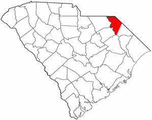
MARLBORO COUNTY SC Cemetery GPS Mapping Project
|
Paul Kankula ( NN8NN )
Webmaster |
|
Gary Flynn ( KE8FD )
GPS Mapping |
MARLBORO COUNTY SC Cemetery GPS Mapping Project
|
Paul Kankula ( NN8NN )
Webmaster |
|
Effective: 12/06/22 08:45 by: PMK |
USGS GEOGRAPHIC NAMES INFORMATION SYSTEM (GNIS) - POPULATED PLACES
https://geonames.usgs.gov/domestic/index.html
GOOGLE MAPS
It's very common for a cemetery to be known by several different names..!
If known, alternate names will be noted somewhere on the county's webpage listing.
Contact Gary Flynn at garyflynn44@yahoo.com, if all you know, is your cemetery's general area.
Cemetery names will normally be listed in alphabetical order. Ex: Brown-Jones-Wilson Families
Surnames will normally come before given names. Ex: Brown Family, John
Plantation names were not ordinarily shown on the Census. Using plantation names to locate ancestors can be difficult because the name of a plantation may have been changed through the years and because the sizeable number of large farms must have resulted in lots of duplication of plantation names.
Plantation nicknames names, if known, will normally be listed as aka (also known as).
It's assumed that if a plantation had over 100 enslaved workers, that there would have normally been a separate cemetery for them. Often landowner's family graves might be located nearby, but always kept separate.
Plantation homes were often burned after slave emancipation, because the landowner could no longer afford to pay their land taxes.
Historical home locations can normally be determined by locating their existing foundations.
|
Cemetery Survey Book Surname Indexes Submitted by:
The following Surname Indexes WILL NOT provide you with an Individual's Date-of-Birth/Death. It will only tell you in what Cemetery Survey Book, your Surname can be found in and on what page number.
Book 1 = Unknown Book Publisher
|
|
Book 1 |
Index | A - | - Z |
|
Family History Library - Books The Church of Jesus Christ of Latter-Day Saints
|
Research Notes:
Marlboro County was named for John Churchill, first Duke of Marlborough (1650-1722). The county name was originally spelled Marlborough, but it was later shortened. The county was created in 1785 as a part of Cheraws District, and the county seat is Bennettsville. Welsh Baptists from Delaware settled in an area of the county known as Welsh Neck around 1737, and they were later joined by English and Scotch-Irish settlers. Cotton growing made this a wealthy part of the state prior to the Civil War. The town of Blenheim was also known for its mineral springs. General Sherman's troops passed through the county in 1865, briefly occupying the town of Bennettsville. Some famous Marlboro County natives are United States Congressman and diplomat Robert Blair Campbell (1791-1862), United States and Confederate Congressman John McQueen (1804-1867), and children's advocate Marian Wright Edelman. (Submitted by: SC State Library / Mary Morgan, 31-Mar-2008)
(1) = Some family cemetery names might only represent a plot (gathering) of family graves,
that are located within a different name & larger cemetery.
(2) = Text File used for miscellaneous information.
(3) = Marlboro County Find-a-Grave Project
(4) = Survey Book Code # = County # - Survey Book # - Page #
AME = African Methodist Episcopal (N) SMC = Southern Methodist Church UMC = United Methodist Church ME = Methodist Episcopal
Zion AME = Zion African Methodist Episcopal (N) CME = Christian Methodist Episcopal (N) = Negro (S) = Slave (C) = Caucasian (I) = Indian (A) = Asian
E-Mail: kankula@bellsouth.net TO REPORT BROKEN LINKS
|
Ref # |
Cemetery Name (1) |
GPS Mapping |
Aerial View |
Road Map |
Photos |
Text (2) |
Find a Grave (3) |
Survey Book (4) |
Location |
|
|
|
|
|
|
|
|
|
||
|
34-001 |
Aaron Temple Holiness |
n34 45.533 , w79 43.917 |
|
|
F |
|
Old Wire Rd & Aaron Temple Church Rd |
||
|
34-002 |
Adams Family |
n34 41.636 , w79 36.247 |
|
|
F |
34-B01-P224 |
Adamsville Rd, north of Stilwell Rd, McColl |
||
|
34-003 |
Adams-Moore Family |
n34 41.250 , w79 35.712 |
|
|
F |
34-B01-P225 |
Adamsville Rd, south of Academy Rd, McColl |
||
|
34-004 |
Ammons Family |
n34 37.660 , w79 36.699 |
|
|
F |
|
us-15 n of mcdonald plantation rd, 1500' w of us-15, look for historical on us-15, Bennettsville |
||
| 34-200 | Antioch UMC Methodist | 34.73221, -79.68486 | A | M | F | Dunbat | |||
|
34-005 |
Asbury UMC Methodist |
n34 32.550 , w79 33.483 |
|
|
F |
|
aka First Corinthians Missionary Baptist
Asbury Rd, north of Norton Circle, Clio |
||
|
34-006 |
Barrington Family |
Can't locate cemetery |
|
|
|
|
34-B01-P144 |
|
|
|
34-007 |
Beauty Spot |
n34 37.483 , w79 38.000 |
|
|
F |
34-B01-P134 |
s/a Beulah
US 15 & Bigfoot Rd, Tatum |
||
|
34-008 |
Beaver Dam |
n34 39.717 , w79 33.433 |
|
|
F |
34-B01-P064 |
US 15, McColl |
||
|
34-009 |
Bennett Family |
n34 41.374 , w79 39.435 |
|
|
F |
34-B01-P256 |
1000' w of bruton fork church rd, s of ford rd, bennettsvilleBruton Church Rd, Lester. |
||
| Berry Family | n34 28.357 , w79 37.547 | A | M | s of strickland rd, e of sr-38, blenheim | |||||
| 34-201 | Bethel Bible Believing | n34 38.337 , w79 30.741 | A | M | F | neck rd & jb flowers circle, McColl | |||
|
34-010 |
Bethel UMC Methodist #1 |
n34 40.000 , w79 43.580 |
|
|
34-B01-P145 |
Rt 9, south of Beverly Ln Bennettsville, Wallace |
|||
|
34-011 |
Bethel UMC Methodist #2 |
n34 47.067 , w79 53.418 |
|
|
|
US 1, south of Kimrey Rd 35-113, Wallace |
|||
|
34-012 |
Bethehelm Baptist |
Can't locate cemetery |
|
|
|
|
|
|
|
|
34-013 |
Bethlehelm UMC Methodist |
n34 23.500 , w79 35.883 |
|
|
F |
|
Berry Rd & Cemetery Ln |
||
|
34-014 |
Blenheim Family |
n34 30.296 , w79 39.196 |
|
|
F |
|
S. Main St, Blenheim |
||
| 34-202 | Blue Family | 34.50325, -79.6985 | A | M | F | Bennettsville | |||
|
34-015 |
Boykin UMC Methodist |
n34 44.550 , w79 38.750 |
|
|
F |
34-B01-P255 |
Rt 79, west of Rt 385 |
||
| 34-203 | Berea Memorial Garden | n34 34.482 , w79 40.085 | A | M | F | sr-38, s of bounty acres rd, Bennettsville | |||
| 34-204 | Berry Family | 34.47295, -79.62578 | A | M | F | ||||
| Blue Family | n34 30.191 , w79 41.910 | A | M | w of salem rd, s of salem rd, s of oak river, bennettville | |||||
|
34-016 |
Breeden Family |
Can't locate cemetery |
|
|
|
|
F |
34-B01-P146 |
Breeden |
|
34-017 |
Bright-Stubbs Family |
n34 43.695 , w79 40.084 |
|
|
F |
34-B01-P104 |
Rt 79, east of Antioch Church Rd, Bennettsville |
||
|
34-018 |
Brigman Family #1 |
n34 44.395 , w79 40.002 |
|
|
34-B01-P007 |
J. Brigman Rd 35-483 |
|||
|
34-019 |
Brigman Family #2 |
n34 44.687 , w79 41.353 |
|
|
34-B01-P007 |
Brigman Rd |
|||
|
34-020 |
Brigman Family #3 |
n34 45.217 , w79 41.533 |
|
|
34-B01-P090 |
Coattail Rd |
|||
|
34-021 |
Brigman Family #4 |
Can't locate cemetery |
|
|
|
|
34-B01-P039 |
|
|
|
34-022 |
Bristow Free Will Baptist |
n34 25.083 , w79 37.150 |
|
|
F |
34-B01-P166 |
Arcadia Rd, west of Rt 38, Bristow |
||
|
34-023 |
Britt-Brock Family |
n34 36.714 , w79 30.291 |
|
|
F |
|
Behind Red Bluff Cemetery, Clio |
||
| 34-205 | Brooks-Kennedy Family |
Can't locate cemetery |
F | Bennettsville | |||||
| 34-206 | Brown Family #1 | n34 40.266 , w79 45.692 | A | M | F | end of honeysuckle ln, Bennettsville | |||
| 34-207 | Brown Family #2 | 34.64151, -79.51304 | A | M | F | McColl | |||
|
34-024 |
Brownsville Baptist |
n34 26.517 , w79 37.600 |
|
|
F |
34-B01-P116 |
Allen Ridge Rd &35-32, Brownsville |
||
|
34-025 |
Brownville Church |
n34 25.560 , w79 39.110 |
|
|
|
aka Rogers
Unknown #1, Screwpin Rd, Bristow. |
|||
|
34-026 |
Bullard Family |
34.70657, -79.70842 |
|
|
F |
34-B01-P108 |
|
||
| 34-208 | Bunker Hill |
Can't locate cemetery |
F | ||||||
| 34-209 | Campbell Family |
Can't locate cemetery |
F | Blenheim | |||||
|
34-027 |
Caulk Family |
n34 44.931 , w79 42.012 |
|
|
F |
34-B01-P032 |
Pineville School Rd, north of Stantons Rd |
||
|
34-028 |
Cedar Fall Missonary Baptist |
n34 29.150 , w79 40.233 |
|
|
F |
|
Cedar Falls Church Rd, east of Salem Rd |
||
|
34-029 |
Chavis Family |
n34 42.235 , w79 44.767 |
|
|
F |
34-B01-P021 |
Big Oak Ln & Chavis Cem. Rd. |
||
| 34-210 | Chisholm Family | n34 34.888 , w79 32.116 | A | M | F | 800' s of carolina rd, 1000' e of red bluff st, Clio | |||
|
34-030 |
Clio UMC Methodist (N) |
n34 34.083 , w79 32.167 |
|
|
|
Rt 9, north of Dunbar Rd |
|||
| 34-211 | Coachman Family | 34.67278, -79.78908 | A | M | F | Wallace | |||
|
34-031 |
Conner Family |
n34 39.386 , w79 36.934 |
|
|
F |
34-B01-P205 |
1500' n of bennettsville fire tower rd &big foot rd, in group of trees in field, bennettsville |
||
| 34-212 | Cotton Mill |
Can't locate cemetery |
F | McColl | |||||
| 34-213 | Covington Place |
Can't locate cemetery |
Bennettsville | ||||||
|
34-032 |
Coxe Family |
n34 25.669 , w79 35.790 |
|
|
F |
34-B01-P254 |
200' s of allen ridge rd, 199' w of gay rdS35-465, Blenheim |
||
| 34-214 | Creech-Quick Family |
Can't locate cemetery |
F | Bennettsville | |||||
| 34-215 | Cross Road |
Can't locate cemetery |
F | Clio | |||||
| 34-216 | Crowley Family |
Can't locate cemetery |
F | 1823 Hwy. 15-401 West, Bennettsville | |||||
|
34-033 |
Daniel's Chapel Holiness |
n34 37.181 , w79 29.975 |
|
|
F |
34-B01-P088 |
Rt 83 to Daniel Chapel Rd. |
||
|
34-034 |
David Family #1 |
Can't locate cemetery |
|
|
|
|
34-B01-P032 |
S35-47 Beauty Spot Rd.W |
|
|
34-035 |
David Family #2 |
Can't locate cemetery |
|
|
|
|
34-B01-P056 |
US 15, 2 1/2 miles from Society Hill |
|
| 34-217 | Dease Family |
Can't locate cemetery |
F | Bennettsville | |||||
| 34-218 | Dew Family |
Can't locate cemetery |
F | 1327 Red Hill Rd, Bennettsville | |||||
| 34-219 | Donoho Family |
Can't locate cemetery |
F | Clio | |||||
|
34-036 |
Douglas Family |
Can't locate cemetery |
|
|
|
|
34-B01-P051 |
off Rt 83, 1/4 mile south of 35-189, east abt 1 mile |
|
|
34-037 |
Drake-Dudley Family |
n34 30.194 , w79 39.162 |
|
|
F |
34-B01-P206 |
Rt 38 |
||
| 34-220 | Driggers Family |
Can't locate cemetery |
F | Wallace | |||||
| 34-221 | Dunbar AME Methodist (N) | 34.52951, -79.55911 | A | M | F | Dunbar | |||
| 34-222 | East Marlboro Baptist | 34.38894, -79.59135 | A | M | F | Brownsville | |||
|
34-038 |
Easterling Family #1 |
n34 39.090 , w79 37.230 |
|
|
34-B01-P146 |
Bennettsville Fire Tower Rd |
|||
|
34-039 |
Easterling Family #2 |
n34 40.590 , w79 43.275 |
|
|
34-B01-P164 |
Muckerman Rd, west of Hickory Grove Rd |
|||
|
34-040 |
Easterling Family #3 |
n34 40.470 , w79 34.625 |
|
|
34-B01-P210 |
west of 35-39 Oscar Fletcher Rd, McColl |
|||
|
34-041 |
Ebenezer Memorial Gardens |
n34 32.750 , w79 31.117 |
|
|
|
Rt 9, south of Ansel Adams Rd, Clio |
|||
|
34-042 |
Ebenezer UMC Methodist |
n34 43.967 , w79 48.467 |
|
|
33-B01-P251 |
aka Oak Grove, Old Wire Rd 35-165 |
|||
|
34-043 |
Ebenezer UMC Methodist |
n34 41.333 , w79 45.983 |
|
|
F |
34-B01-P128 |
aka Prospect & Quick Bass
Rt 9 & Ebenezer Rd. |
||
|
34-044 |
Ebenezer Missionary Baptist |
n34 32.278 , w79 30.863 |
|
|
|
Rt 9, at Ebenezer Church Rd, Clio |
|||
| 34-224 | Ellis Family |
Can't locate cemetery |
F | ||||||
| 34-225 | Ellison Family | 34.78692, -79.70563 | A |
M |
F | ||||
|
34-045 |
English Family |
n34 45.468 , w79 39.552 |
|
|
F |
|
aka Wallace
McCormick Rd, Bennettsville |
||
|
34-046 |
Evergreen |
n34 36.517 , w79 41.150 |
|
|
F |
34-B01-P001 |
Hudson St & Ayers St, Bennetsville |
||
| 34-226 | Fair Plain |
Can't locate cemetery |
F | McColl | |||||
| 34-227 | Faith Full Gospel |
Can't locate cemetery |
F | McColl | |||||
| 34-228 | Faith Temple Holiness | n34 43.970 , w79 41.710 | A | M | F | antioch church rd, w of white hall rd, Bennettsville | |||
| 34-229 | First Corinthians Missionary Baptist |
n34 30.534 , w79 38.540 |
A | M | F |
aka Diggers Chapel & Mineral Springs Baptist rt-381, e of blenheim |
|||
|
34-047 |
First Methodist of Bennettsville |
n34 37.133 , w79 40.800 |
|
|
F |
|
E.ain & Lindsay Ave |
||
| 34-230 | First Mineral Springs Baptist | 34.50932, -79.64220 | A | M | F | Blenheim | |||
|
34-048 |
Fletcher's Chapel Wesleyan |
n34 43.189 , w79.35.996 |
|
|
F |
34-B01-P095 |
Highway 381, Fletcher |
||
|
34-049 |
Fletcher's Memorial School |
n34 41.983 , w79 35.167 |
|
|
F |
34-B01-P228 |
Located near school, McColl |
||
| 34-231 | Frasher Family |
Can't locate cemetery |
F | Clio | |||||
| 34-232 | Freeman-Leviner Family | n34 48.333 , w79 45.498 | A | M | F | 1500' e of holmes rd, 100' s of nc state line | |||
| 34-233 | Garner Family | 34.62584, -79.67725 | A | M | F | Bennettsville | |||
| 34-224 | Gibson Family | n34 39.837 , w79 33.111 | A | M | F | 100' w of gibson ave, on n side of allen st, mccoll | |||
|
34-052 |
Gillespie-Shipp Family |
n34 43.079 , w79 51.951 |
A | M |
|
|
F |
34-B01-P085 |
600' w of us-1, s of david lane, Wallace |
|
34-053 |
Goodwins Chapel AME Methodist (N) |
n34 43.903 , w79 39.184 |
|
|
F |
|
Newton Rd, south of Rt 79, McColl |
||
|
34-138 |
Grant-Steen Family |
n34 47.300 , w79 43.036 |
A |
|
|
F |
34-B01-P102 |
Steen Rd, west of Rt 38 |
|
| 34-225 | Grant-Turner Family | 34.68961, -79.76572 | A | M | F | Bennettsville | |||
| 34-226 | Gray Family | 34.45340, -79.62099 | A | M | F | Blenheim | |||
| 34-227 | Greater Fair Plains AME Zion Methodist (N) | 34.66506, -79.53220 | A | M | F | No cemetery found | |||
|
34-055 |
Groveton Family |
34.55638, -79.72829 |
|
|
F |
34-B01-P085 |
on Brushy Bay Rd, Bennetsville. |
||
| 34-228 | Hailey Family |
Can't locate cemetery |
F | Wallace | |||||
|
34-056 |
Hamer Family #1 |
n34 38.950 , w79 35.750 |
|
|
34-B01-P147 |
Manship & Firetower Rd. |
|||
|
34-057 |
Hamer Family #2 |
Can't locate cemetery |
|
|
F |
34-B01-P209 |
Highway 15 toward Tatum |
||
| 34-229 | Haney Family | 34.57995, -79.72771 | A | M | F | Bennettsville | |||
|
34-058 |
Harrington |
n34 43.231 , w79 51.680 |
|
|
34-B01-P089 |
US 1 near Rt 9 |
|||
| 34-230 | Harrison Family |
n34 43.196 , w79 45.637 |
A | M | F | e of ebenezer rd, 900' n o pee dee rd, wallace | |||
| 34-231 | Hart Family |
Can't locate cemetery |
F | Bennettsville | |||||
|
34-059 |
Hebron UMC Methodist |
n34 34.600 , w79 35.600 |
|
|
F |
34-B01-P237 |
Hebron Church Rd, Clio |
||
| 34-232 | Hepburn Family |
Can't locate cemetery |
F | Bennettsville | |||||
|
34-060 |
Heustess-Spears Family |
Can't locate cemetery |
|
|
|
|
F |
|
off Airport Rd, Bennettsville |
|
34-061 |
Hickory Grove Baptist |
n34 42.367 , w79 47.300 |
|
|
F |
34-B01-P109 |
Irby Rd & Hickory Grove Rd, Wallace |
||
| 34-233 | Hickory Grove UMC Methodist | n34 36.414 , w79 32.458 | A | M | F | ottis parrish rd, s f laurin willis rd, Clio | |||
|
34-062 |
Hill Farm |
Can't locate cemetery |
|
|
|
|
F |
34-B01-P092 |
Hwy 18 on Hill farm, Blenheim |
|
34-063 |
Hodges Family |
n34 23.532 , w79 35.893 |
|
|
34-B01-P250 |
||||
|
34-065 |
Holy Rood |
n34 30.210 , w79 39.140 |
|
|
F |
34-B01-P234 |
aka Old Blenheim Presbyterian |
||
| 34-234 | Hood Family |
Can't locate cemetery |
F | Brownsville | |||||
|
34-066 |
Hopewell Church |
n34 38.000 , w79 34.950 |
|
|
F |
|
Tatum Hwy |
||
|
34-067 |
Hubbard Family #1 |
n34 41.360 , w79 42.490 |
|
|
F |
34-B01-P112 |
S35-187 Radio Rd, on Searcy farm |
||
|
34-068 |
Hubbard Family #2 |
n34 43.083 , w79 41.183 |
|
|
F |
34-B01-P144 |
On Hwy 79, 1.5m W of Hwy 38 towards Gibson |
||
|
34-069 |
Hunsucker Family |
n34 44.499 , w79 38.840 |
|
|
F |
34-B01-P254 |
before Boykin Methodist Church, Boykin |
||
|
34-070 |
Iceman Cotton Mill |
Can't locate cemetery |
|
|
|
|
F |
|
|
|
34-071 |
Ideal Family |
n34 38.400 , w79 40.133 |
|
|
F |
|
Wallace Rd |
||
| 34-235 | Irby Family |
Can't locate cemetery |
F | Bennettsville | |||||
|
34-072 |
Ivy Family |
n34 35.920 , w79 29.890 |
|
|
F |
34-B01-P249 |
aka Ivey
Highway 9 toward Clio |
||
| 34-237 | Jacksob-Murchison Family |
Can't locate cemetery |
F | Clio | |||||
| 34-238 | Johnakin Family |
Can't locate cemetery |
F | ||||||
| 34-239 | Jones Family | n34 40.390 , w79 39.518 | A | M | F | 4000' e of factory ln, Bennettsville | |||
|
34-073 |
Kolbs Tomb, Colonel |
n34 32.217 , w79 49.617 |
|
|
F |
34-B01-P146 |
Kolb's Tomb Rd |
||
| 34-240 | Locklear Family |
Can't locate cemetery |
F | ||||||
|
34-074 |
Lemon Family |
n34 45.327 , w79 42.230 |
|
|
F |
|
Lemon Ln east of Rt 38 |
||
| 34-241 | Lemon Memorial Garden | n34 40.336 , w79 47.401 | A | M | F | s of community rd, w of irby rd, Wallace | |||
|
34-075 |
Lester Family |
n34 40.765 , w79 38.999 |
|
|
F |
34-B01-P179 |
aka Smyrna
east of RT 385, Lester |
||
|
34-076 |
Level Green |
n34 39.783 , w79 43.383 |
|
|
F |
|
Rt 9, near Level Green Church Rd, Bennettsville |
||
| 34-242 | Liberty Christian Community | n34 41.481 , w79 33.976 | M | F | s of rt-381, s of barfield rd, McColl | ||||
| 34-243 | Lighthouse Ministries | n34 48.096 , w79 46.865 | A | M | F | w of rt-177, n of langley rd, Wallace | |||
|
34-077 |
Liles Family |
n34 42.310 , w79 40.070 |
|
|
F |
34-B01-P086 |
Antioch Church Rd. |
||
| 34-244 | Loyd Family | 34.75458, -79.70767 | A | M | F | ||||
|
34-078 |
Macedonia Missionary Baptist (N) |
n34 32.333 , w79 42.300 |
|
|
F |
|
Salem Rd, north of Coxe Rd |
||
|
34-079 |
Manship Family |
n34 39.820 , w79 35.272 |
|
|
F |
34-B01-P092 |
Adamsville Rd & Gorlib Rd |
||
|
34-080 |
McCall Family |
n34 37.567 , w79 40.500 |
|
|
F |
34-B01-P183 |
N.Cook St & Weatherly St, Bennettsville |
||
|
34-081 |
McColl Family |
Can't locate cemetery |
|
|
|
|
F |
34-B01-P106 |
reinterred at McLucas Cemetery |
|
34-082 |
McDaniel Family |
Can't locate cemetery |
|
|
|
|
|
Cottingham Farm Rd, Clio |
|
| 34-246 | McDowell Memorial | n34 23.739 , w79 34.937 | A | M | F | rt-34 e, just s of rt-34, blenheim | |||
|
34-083 |
McGinnis Family |
Can't locate cemetery |
|
|
|
|
34-B01-P089 |
off Hwy 38 |
|
| 34-247 | McKinnon Family | n34 48.298 , w79 46.136 | A | M | F | e of holmes rd, 300' s of nc state line, wallace | |||
|
34-084 |
McLaurin Family |
n34 40.150 , w79 32.483 |
|
|
F |
34-B01-P054 |
E Dr & McLaurin Ave |
||
| 34-248 | McLeod-Rogers Family |
Can't locate cemetery |
Bennettsville | ||||||
|
34-085 |
McLucas Family |
n34 33.550 , w79 32.867 |
|
|
F |
34-B01-P152 |
aka Askew
Dunbar Rd, west of Rt 9 |
||
|
34-086 |
McQuage Family |
n34 40.805 , w79 46.025 |
|
|
F |
34-B01-P210 |
McQuage Hill Rd, west of Rt 912 |
||
| 34-249 | Mission of Faith | n34 43.390 , w79 51.404 | A | M | F | albert lane, s of delta heights rd, Wallace | |||
| 34-250 | Moody Family | n34 34.731 , w79 44.271 | A | M | F | pebble rd, e of mineral lane, Bennettsville | |||
|
34-088 |
Moore Family |
n34 42.446 , w79 46.229 |
|
|
F |
34-B01-P234 |
south of Hickory Grove Rd, S35-55 |
||
|
34-089 |
Mossy Bay |
n34 28.370 , w79 37.140 |
|
|
F |
34-B01-P249 |
Strickland Ln, east of Rt 38 |
||
|
34-090 |
Mount Elim Freewill Baptist |
n34 35.530 , w79 33.610 |
|
|
F |
34-B01-P093 |
aka Mount Elohim
Tatum Hwy, north of Rt 9, Clio |
||
| 34-252 | Mount Misery | n34 40.352 , w79 32.371 | A | M | F | n end of king st, McColl | |||
| 34-253 | Mount Tabor Baptist | 34.56974, -79.54426 | A | M | F | can't locate any cemetery, Clio | |||
|
34-091 |
Mumford Family |
n34 30.720 , w79 39,835 |
|
|
F |
34-B01-P088 |
Gravel Pit Rd S35-50, west of W High St, Bennettsville |
||
| 34-254 | Munnerlyn Family, Caesar |
Can't locate cemetery |
Red Bluff | ||||||
|
34-093 |
New Covenant Free Rock |
n34 34.003 , w79 32.035 |
|
|
F |
|
on Galloway Ln, east of Rt 9, Clio |
||
| 34-258 | New Galilee UMC Methodist |
Can't locate cemetery |
F | ||||||
|
34-094 |
New Hill Freewill Baptist |
n34 42.733 , w79 41.950 |
|
|
F |
|
Rt 79, east of Stubbs Ln, Bennettsville |
||
|
34-095 |
New Hope UMC Methodist |
n34 48.250 , w79 53.433 |
|
|
F |
34-B01-P040 |
Marthas Ln, west of US 1, Wallace |
||
|
34-096 |
Newton Family #1 |
n34 42.750 , w79 36.633 |
|
|
F |
34-B01-P125 |
Adamsville Rd, north of Spice Rd 35-411, Newtonville |
||
|
34-097 |
Newton Family #2 |
n34 43.062 , w79 38.408 |
|
|
F |
34-B01-P147 |
aka Adams
Rt 385, north of Family Farm Rd, Adamsville crossroads |
||
| 34-259 | Newtonville Community |
Can't locate cemetery |
F | McColl | |||||
| 34-260 | Norton Family | n34 40.122 , w79 33.174 | A | M | F | 250' w of us-15, s of marlboro st, McColl | |||
|
34-098 |
Oak Grove Church |
n34 36.410 , w79 32.470 |
|
|
|||||
|
34-099 |
Oak Grove UMC Methodist |
n34 44.582 , w79 48.981 |
|
|
F |
34-B01-P033 |
aka White Oak
Hatcher Hill Rd, west of Rt 177 |
||
|
34-100 |
Oak Ridge Community |
n34 37.683 , w79 40.600 |
|
|
F |
34-B01-P008 |
Rt 385 & N. Cook St, Bennettsville |
||
|
34-101 |
Odom Family |
Can't locate cemetery |
|
|
|
|
F |
34-B01-P147 |
Rt 38 toward Hamlet |
| 34-261 | Oneal Family |
Can't locate cemetery |
F | Brownsville | |||||
|
34-102 |
Parker Family, Moses |
n34 41.425 , w79 34.318 |
|
|
F |
34-B01-P103 |
east of Chesea Ln, off RT 381, McColl |
||
|
34-103 |
Parnassus Family |
n34 29.567 , w79 38.733 |
|
|
F |
34-B01-P137 |
Parnassus Rd, west of Rt 38, Blenheim |
||
|
34-104 |
Parrish Family |
n34 35.255 , w79 38.299 |
|
|
F |
34-B01-P090 |
east of Palmetto Chase Rd 35-399, Marlboro |
||
|
34-105 |
Pearce Family |
n34 39.444 , w79 40.670 |
|
|
F |
34-B01-P205 |
75' n, 200' from end of industrial ln, bennettsville |
||
|
34-106 |
Pearson Family |
n34 40.650 , w79 38.590 |
|
|
34-B01-P084 |
Beverrly Creek Rd, west of Rt 385 |
|||
| 34-262 | Pee Dee Missionary Baptist | n34 32.555 , w79 39.263 | A | M | F |
aka Great Pee Dee Presbyterian rt-38, s of coxe rd, Blenheim |
|||
| 34-263 | Peele Family | n34 46.533 , w79 38.385 | A | M | F | w of pearson rd, at state line, cemetery in both sc & nc | |||
|
34-107 |
Piney Grove Friends |
n34 41.967 , w79 35.233 |
|
|
|
|
F |
|
piney grove church rd, s of hubbard farm rd, can't confirm if cemetery is at this location |
|
34-108 |
Pleasant Hill Missionary Baptist |
n34 26.900 , w79 37.800 |
|
|
F |
|
Rt 38, Blenheim |
||
|
34-109 |
Pleasant Hill UMC Methodist |
n34 47.950 , w79 48.167 |
|
|
F |
34-B01-P045 |
aka White Creek
S35-37 |
||
|
34-110 |
Polston Family |
n34 37.631 , w79 34.446 |
|
|
F |
34-B01-P257 |
Tatum Hwy 35-22, Tatum |
||
| 34-245 | Poor Farm, Marlboro County |
Can't locate cemetery |
F | ||||||
| 34-144 | Prevatts Chapel | n34 47.550 , w79 42.733 |
aka Sandhill Wesleyan SR-38 & Prevatts Chapel Rd, Bennettville |
||||||
|
34-157 |
Priest Family |
n34 38.680 , w79 29.300 |
A |
|
|
F |
34-B01-P232 |
Berea section highway 381 from McColl |
|
| 34-264 | Prince Plantation, Ann E. |
Can't locate cemetery |
231 Slaves in 1860, Existing Family & Slave cemetery(?) | ||||||
|
34-112 |
Quick Family #1 |
n34 35.900 , w79 33.833 |
|
|
34-B01-P052 |
aka Peele ,Cemetery Rd, east S35-22 |
|||
|
34-113 |
Quick Family #2, Ebbie |
n34 46.667 , w79 40.700 |
|
|
F |
34-B01-P107 |
S35-166, Bennettsville |
||
|
34-114 |
Quick Family #3 |
n34 43.667 , w79 45.233 |
|
|
34-B01-P253 |
S35-522, Pee Dee Rd, north of Rt 9 |
|||
|
34-115 |
Quick Family #4 |
Can't locate cemetery |
|
|
|
|
34-B01-P254 |
Hwy 38 toward Hamlet |
|
|
34-117 |
Red Bluff |
n34 36.707 , w79 30.297 |
|
|
F |
34-B01-P057 |
Bluff Cem. Rd & American Legion Rd. |
||
|
34-118 |
Reedy Branch Baptist |
n34 37.533 , w79 28.533 |
|
|
F |
|
Rt 83 & Reedy Branch Ln. |
||
|
34-119 |
Reedy Branch |
n34 36.967 , w79 29.017 |
|
|
|
east of RT 83, south of Reedy Branch Ln. |
|||
| 34-265 | Riddle Family |
Can't locate cemetery |
F | 912 Salem Rd, Bennettsville | |||||
|
34-120 |
Roberts Family |
n34 42.379 , w79 47.316 |
|
|
F |
|
adjacent to Hickory Grove Baptist |
||
|
34-121 |
Rogers Family #1 |
n34 39.777 , w79 33.465 |
|
|
34-B01-P170 |
US 15, McColl, across from Beaver Dam Cemetery |
|||
|
34-122 |
Rogers Family #2 |
n34 25.560 , w79 39.110 |
|
|
F |
34-B01-P266 |
aka Old Brownville Church |
||
| 34-266 | Roscoe Family | n34 32.804 , w79 42.799 | A | M | F | 200' w of 1250 stoneway ln, bennettsville | |||
|
34-123 |
Roselawn |
n34 39.697 , w79 33.538 |
|
|
F |
|
next Rogers #1, US 15, McColl |
||
| 34-145 | Saint Mark Baptist | n34 36.585 , w79 45.785 | F | Williametta Rd & McCalls Mill Rd, Bennettville | |||||
|
34-124 |
Saint Paul AME Zion Methodist (N) |
n34 42.100 , w79 36.417 |
|
|
F |
|
Adamsville Rd, south of Bradley Rd, McColl |
||
|
34-125 |
Salem Baptist |
n34 32.150 , w79 42.233 |
|
|
F |
34-B01-P022 |
Salem Rd, north of Coxe Rd, Bennettsville |
||
|
34-126 |
Sandy Grove Missionary Baptist |
n34 35.233 , w79 37.583 |
|
|
F |
|
Sandy Grove Church Rd, south of Hebron Dunbar Rd, Bennettsville |
||
|
34-127 |
Sardis Church |
n34 30.250 , w79 39.900 |
|
|
F |
|
Hunts Bluff Rd, west of RT 38, near Judy Ln, Blenheim |
||
|
34-128 |
Sarion Baptist |
n34 37.250 , w79 32.567 |
|
|
F |
|
aka Syrrian Baptist
S35-337 Sarion Ch. Rd, north of Laurin Willis Rd |
||
|
34-129 |
Sawmill Baptist |
n34 37.617 , w79 46.450 |
|
|
F |
34-B01-P255 |
Sawmill Church Rd, west of RT 912, Bennettsville |
||
| 34-268 | Shields Family | n34 46.082 , w79 47.734 | A | M | F | rt-177 & gurney rd, Wallace | |||
|
34-130 |
Shiloh Baptist (N) |
n34 44.050 , w79 39.133 |
|
|
F |
34-B01-P177 |
Newton Rd. S35-142, east of Rt 79, Bennettsville |
||
|
34-131 |
Shiloh UMC Methodist |
n34 35.867 , w79 44.750 |
|
|
F |
|
Shiloh Ch. Rd. north of US 15, Bennettsville |
||
| 34-269 | Simmons Family |
Can't locate cemetery |
F | Clio | |||||
|
34-132 |
Smith Family |
n34 45.786 , w79 43.173 |
|
|
F |
34-B01-P089 |
west of RT 38 on S35-165 on left, Wallace |
||
|
34-133 |
Smyrna UMC Methodist |
n34 40.617 , w79 39.150 |
|
|
F |
34-B01-P087 |
Rt 385, south of Beverly Creek Rd |
||
|
34-134 |
Smyrna Church |
n34 40.817 , w79 39.228 |
|
|
|
west of Rt 385, north of Beverly Creek Rd, Lester |
|||
| 34-271 | Sparks Plantation, Samuel |
Can't locate cemetery |
166 Slaves in 1860, Existing Family & Slave cemetery(?) | ||||||
| 34-272 | Spears UMC Methodist |
n34 35.783 , w79 36.617 |
|
|
|
Spears Church Rd, north of Rt 9 |
|||
|
34-136 |
Spears Family |
n34 35.550 , w79 36.230 |
A |
|
|
F |
34-B01-P132 |
Spears Cemetery Rd. 35-273 |
|
|
34-137 |
Stanton Family |
n34 36.922 , w79 33.078 |
A |
|
|
F |
34-B01-P091 |
Laurin Willis Rd, & Neville Bennett Rd, Clio |
|
| 34-273 | Steen Family | n34 47.316 , w79 42.991 | A | M | F | steen rd, w of rt-38, Bennettsville | |||
|
34-139 |
Sunset Memorial Park |
n34 36.517 , w79 42.450 |
A |
|
|
F |
34-B01-P210 |
US 15, West Main St. Bennettsville |
|
|
34-140 |
Tatum Community |
n34 38.910 , w79 34.770 |
A |
|
|
F |
34-B01-P166 |
US 15, west of Adamsville Rd, Tatum |
|
|
34-141 |
Teague Family |
n34 44.520 , w79 38.755 |
|
|
F |
34-B01-P089 |
s of rt-79, w of pearson rd, bennettsville |
||
| 34-275 | Teal Family | n34 43.950 , w79 41.480 | A | M | F | Bennettsville | |||
|
34-142 |
Thomas Memorial Baptist |
n34 36.867 , w79 41.250 |
A |
|
|
F |
34-B01-P152 |
McColl St, Bennettsville |
|
|
34-143 |
Townsend |
Can't locate cemetery |
|
|
|
|
34-B01-P108 |
Rt 38 |
|
| 34-276 | Townsend Plantation, Light |
Can't locate cemetery |
101 Slaves in 1860, Existing Family & Slave cemetery(?) | ||||||
| 34-277 | Trinty UMC Methodist | n34 34.467 , w79 40.017 | A | M | F |
aka Gaililee rt-38 s of bounty acres rd, bennettsville |
|||
| 34-278 | True Gospel Emanuel Holiness | n34 42.881 , w79 47.754 | A | M | F |
34-B01-P228 |
aka Wallace Baptist & Harrington Family grant mill rd, w of irby rd, wallace |
||
|
34-148 |
Unknown Name #05 |
n34 34.450 , w79 31.320 |
A |
|
|
|
Heidt Rd. SC342 north of Sandy Ln. |
||
|
34-152 |
Unknown Name #09 |
n34 37.140 , w79 33.660 |
A |
|
|
|
north of Laurin Willis Rd, west of Riley Hinson Rd. |
||
|
34-155 |
Unknown Name #12 |
n34 38.330 , w79 38.030 |
A |
|
|
|
west of Big Foot Rd, about 1 mile north of US 15 |
||
|
34-161 |
Unknown Name #18 |
n34 40.740 , w79 49.310 |
A |
|
|
|
1/2 mile west of Beaverdam Ch, Southeast of Community Rd |
||
|
34-162 |
Unknown Name #19 |
n34 41.690 , w79 48.940 |
A |
|
|
|
southside of Hickory Grove Rd,1/2 mile NE of Community Rd |
||
|
34-167 |
Unknown Name #24 |
n34 43.730 , w79 42.710 |
A |
|
|
|
east of Grants Mill,1/2 mile west of Rt 38 |
||
|
34-172 |
Unknown Name #29 |
n34 23.532 , w79 35.893 |
A |
|
|
|
Cemetery Rd. off RT 38 |
||
|
34-175 |
Unknown Name #32 |
n34 42.691 , w79 36.336 |
A |
|
|
|
north of Spice Rd, east of Adamsville Rd. |
||
| 34-279 | Weatherly Plantation, T.C. |
Can't locate cemetery |
102 Slaves in 1860, Existing Family & Slave cemetery(?) | ||||||
| 34-280 | Weatherspoon Plantation, John |
Can't locate cemetery |
110 Slaves in 1860, Existing Family & Slave cemetery(?) | ||||||
|
34-178 |
Webster Family |
Can't locate cemetery |
|
|
|
|
F |
34-B01-P106 |
cemetery on grounds of federal correction institution, muckerman rd, bennettsville. |
|
34-179 |
Wesley Chapel UMC Methodist |
n34 42.967 , w79 44.400 |
A |
|
|
F |
|
S35-257 Aaron Temple Rd, south of Grant Mill Rd |
|
| 34-281 | Westbay Family |
Can't locate cemetery |
F | 1569 Neck Road, McColl | |||||
| 34-146 | White Creek Baptist | n34 44.140 , w79 51.990 |
A |
Billy Wallace Rd, e of US1, Wallace | |||||
|
34-180 |
White Creek Free Will Baptist |
n34 46.500 , w79 47.950 |
A |
|
|
F |
34-B01-P038 |
White Creek Rd & Gurney Rd, Wallace |
|
| 34-282 | Williams Family |
Can't locate cemetery |
F | Bennettsville | |||||
| 34-285 | Word of Life Memorial | 34.63751, -79.65569 | A | M | F | Bennettsville | |||
|
34-181 |
Wright Family |
n34 31.110 , w79 31.570 |
A |
|
|
F |
34-B01-P107 |
Hebron-Dunbar Rd, east of Quail Farm Rd, Clio. |
|
|
|
|||||||||
|
|
|
|
|
|
|
|
34-300 |