|
Gary Flynn ( KE8FD )
GPS Mapping |
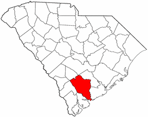
COLLETON COUNTY SC Cemetery GPS Mapping Project
|
Paul Kankula ( NN8NN )
Webmaster |
|
Gary Flynn ( KE8FD )
GPS Mapping |
COLLETON COUNTY SC Cemetery GPS Mapping Project
|
Paul Kankula ( NN8NN )
Webmaster |
|
Effective: 01/09/23 14:44 by: PMK |
USGS GEOGRAPHIC NAMES INFORMATION SYSTEM (GNIS) - POPULATED PLACES
https://geonames.usgs.gov/domestic/index.html
GOOGLE MAPS
It's very common for a cemetery to be known by several different names..!
If known, alternate names will be noted somewhere on the county's webpage listing.
Contact Gary Flynn at garyflynn44@yahoo.com, if all you know, is your cemetery's general area.
Cemetery names will normally be listed in alphabetical order. Ex: Brown-Jones-Wilson Families
Surnames will normally come before given names. Ex: Brown Family, John
Plantation names were not ordinarily shown on the Census. Using plantation names to locate ancestors can be difficult because the name of a plantation may have been changed through the years and because the sizeable number of large farms must have resulted in lots of duplication of plantation names.
Plantation nicknames names, if known, will normally be listed as aka (also known as).
It's assumed that if a plantation had over 100 enslaved workers, that there would have normally been a separate cemetery for them. Often landowner's family graves might be located nearby, but always kept separate.
Plantation homes were often burned after slave emancipation, because the landowner could no longer afford to pay their land taxes.
Historical home locations can normally be determined by locating their existing foundations.
|
Old Saint Bartholomew Chapter of SC Genealogical Society Cemetery Survey Book Surname Indexes Submitted by: Larry Ulmer
The following Surname Indexes WILL NOT provide you with an Individual's Date-of-Birth/Death. It will only tell you in what Cemetery Survey Book, your Surname can be found in and on what page number.
Book 1 = Lower Colleton County Cemeteries (68)
Book 2 = Live Oak Cemetery in Walterboro
Book 3 = Upper Colleton County Cemeteries (89)
|
| Book 1 | Information | Cemeteries | Surnames | |||
| Book 2 | Information | Cemeteries | Surnames | |||
| Book 3 | Information | Cemeteries | Surnames 1 | Surnames 2 | Surnames 3 | Surnames 4 |
|
Miscellaneous Reference
Book 1 = Cemeteries of Upper Colleton County, 1974, by Evelyn Bryan, Frazier Bryan & Gibson Bryan
Family History Library - Books The Church of Jesus Christ of Latter-Day Saints
|
| Book 1 | Information & Cemeteries |
Research Notes:
Colleton County was named for one of the Lords Proprietors, Sir John Colleton (1608-1666). The county was first created in 1682 under the proprietary government, but the designation was seldom used in the colonial period. Instead, the area was known by its parish names: St. Bartholomew, St. Paul, and St. George Dorchester. In 1769 these parishes became part of Charleston District, where they remained until Colleton District was formed in 1800. The county seat is Walterboro. A portion of the county was removed in 1897 to form Dorchester County. Several Revolutionary War skirmishes took place in Colleton County, and the state legislature met in the town of Jacksonboro in 1782 while Charleston was occupied by the British. In 1828 the first nullification meeting in the state was held in Walterboro. This part of the low country was known for its extensive rice and cotton plantations. Many of the old plantations were bought by Northerners after the Civil War for use as hunting preserves; some of those lands are now being incorporated into the ACE Basin, a nature preserve bounded by the Ashepoo, Combahee, and Edisto rivers. The Revolutionary War hero Isaac Hayne (1745-1781) was a Colleton resident, as were politicians Rawlins Lowndes (1721-1800) and William Lowndes (1782-1822). (Submitted by: SC State Library / Mary Morgan, 31-Mar-2008)
(1) & (3) =
Some F-a-G cemetery name submittals only represent a plot (gathering) of family graves -- that's located within another cemetery!
Some F-a-G church name submittals only represent a church's building location -- that doesn't have an adjoining cemetery!
Some posted F-a-G GPS locations are very inaccurate and will rarely ever get corrected by its submitter!
(2) = Text File for miscellaneous information.
(3) = Colleton County Find-a-Grave Project
(4) = Survey Book Code # = County # - Survey Book # - Page #
AME = African Methodist Episcopal(N) SMC = Southern Methodist Church UMC = United Methodist Church ME = Methodist Episcopal
Zion AME = Zion African Methodist Episcopal(N) CME = Christian Methodist Episcopal (N) = Negro (S) = Slave (C) = Caucasian (I) = Indian (A) = Asian
|
Ref # |
Cemetery Name (1) |
GPS Mapping |
Aerial View |
Road Map |
Photos |
Text (2) |
Find a Grave (3) |
Survey Book # (4) |
Location |
|
|
|
|
|
|
|
|
|
||
|
15-001 |
Abraham CME Methodist (N) |
n32 46.230 , w80 42.170 |
A |
|
|
F |
|
Ritter Rd, west of White-Hall Rd, Yemassee |
|
|
15-002 |
Ackerman at Red Oak |
n32 59.117 , w80 27.133 |
|
|
F |
15-B1-P001 |
west of Red Oak Rd, north of Timber-Bay, Cottageville |
||
|
15-003 |
Ackerman at Round O |
n32 56.457 , w80 32.823 |
|
|
F |
15-B1-P013 |
700' w of Lemuel Ave, 1000' n of us-17 alternate, Round O |
||
|
15-004 |
Adams-McMillian Family |
n32 57.100 , w80 29.433 |
|
|
F |
15-B1-P015 |
Rt 651, north of US 17, Cottageville |
||
|
15-006 |
Adnah UMC Methodist |
n32 53.583 , w80 53.183 |
|
|
F |
15-B3-P356 |
Adnah Church Rd, Lodge |
||
|
15-084 |
Avant-Fender Family |
can't locate cemetery |
|
|
|
|
F |
|
Walterboro |
| 15-400 | Aikin Plantation, William | can't locate cemetery | Wadmalaw Island, 700 Slaves in 1860, Existing Family & Slave cemetery(?) | ||||||
|
15-007 |
Aimwell Presbyterian |
n32 49.550 , w80 33.517 |
|
|
F |
|
Featherbed Rd, north of Rt 64, Round O |
||
|
15-008 |
Antioch Baptist (N) |
n32 46.690 , w80 27.880 |
A |
|
|
F |
|
Rt 64, north of US 17, Green Pond |
|
|
15-009 |
Ashepoo Fee Farm (N) |
can't locate cemetery |
|
|
|
|
F |
|
Ashe? |
|
15-010 |
Ashton Branch Christian |
n33 01.300 , w80 58.500 |
|
|
F |
15-B3-P279 |
Ashton Rd, s of Rt 642, Lodge |
||
| 15-402 | Bailey Plantation, Anna | can't locate cemetery | Wadmalaw Island, 133 Slaves in 1860, Existing Family & Slave cemetery(?) | ||||||
| 15-403 | Bailey Plantation, Constantine | can't locate cemetery | Edisto Island, 115 Slaves in 1860, Existing Family & Slave cemetery(?) | ||||||
| 15-404 | Bailey Plantation, E.C. | can't locate cemetery | Edisto Island, 102 Slaves in 1860, Existing Family & Slave cemetery(?) | ||||||
| 15-405 | Bailey Plantation, William C. | can't locate cemetery | Wadmalaw Island, 82 Slaves in 1860, Existing Family & Slave cemetery(?) | ||||||
| 15-406 | Bailey Plantation, William M. | can't locate cemetery | Edisto Island, 206 Slaves in 1860, Existing Family & Slave cemetery(?) | ||||||
| 15-407 | Barker Plantation, R.L. | can't locate cemetery | Bartholomew;s, 157 Slaves in 1860, Existing Family & Slave cemetery(?) | ||||||
| 15-408 | Baring Plantation, Charles | can't locate cemetery | Saint Paul's, 101 Slaves in 1860, Existing Family & Slave cemetery(?) | ||||||
|
15-011 |
Baldwin Family |
n32 32.750 , w80 25.340 |
|
|
F |
15-B1-P016 |
east of Baldwin Ln, Green Pond |
||
|
15-012 |
Baptist Hill Memorial Gardens (N) |
n32 52.758 , w80 29.359 |
|
|
F |
|
250' w of jacksonboro, n of round o rd, Round O, abt 200' w of church hill cemetery |
||
| 15-409 | Barnwell Plantation, Edward | can't locate cemetery | Saint Paul's, 245 Slaves in 1860, Existing Family & Slave cemetery(?) | ||||||
| 15-410 | Barr Family | can't locate cemetery | F | 3631 Red Oak Road, Cottageville | |||||
|
15-013 |
Barry Family |
can't locate cemetery |
|
|
|
|
|
family property in Cottageville |
|
|
15-014 |
Battleham (N) |
can't locate cemetery |
|
|
|
|
|
|
|
| 15-411 | Baynard Plantation, Edward | can't locate cemetery | Edisto Island, 245 Slaves in 1860, Existing Family & Slave cemetery(?) | ||||||
| 15-412 | Baynard Plantation, E.M. | can't locate cemetery | Edisto Island, 81 Slaves in 1860, Existing Family & Slave cemetery(?) | ||||||
| 15-413 | Baynard Plantation, E.M. | can't locate cemetery | Edisto Island, 370 Slaves in 1860, Existing Family & Slave cemetery(?) | ||||||
| 15-414 | Baynard Plantation, T.A. | can't locate cemetery | Edisto Island, 120 Slaves in 1860, Existing Family & Slave cemetery(?) | ||||||
| 15-415 | Baynard Plantation, William G. | can't locate cemetery | Edisto Island, 220 Slaves in 1860, Existing Family & Slave cemetery(?) | ||||||
|
15-015 |
Bedon Baptist |
n32 55.150 , w80 36.833 |
|
|
F |
15-B1-P017 |
US 17,east of Bedon Rd, Walterboro |
||
|
15-016 |
Behling Family (N) |
can't locate cemetery |
|
|
|
|
F |
|
Smoaks |
|
15-017 |
Bellinger Family |
n32 43.461 , w80 33.634 |
|
|
15-B1-P056 |
aka Poco Sabo Plantation,
Poco Sabo Ln, s of us-17 Green Pond |
|||
| 15-416 | Bellinger Plantation, E.E. | can't locate cemetery | Saint Bartholomew's, 123 Slaves in 1860, Existing Family & Slave cemetery(?) | ||||||
| 15-417 | Belton Family |
can't locate cemetery |
F | Ruffin | |||||
|
15-018 |
Bennett Family |
n33 03.455 , w80 50.547 |
|
|
F |
15-B3-P290 |
2889 Mill Pond Rd, Ruffin |
||
|
15-019 |
Bennett-Spell (N) |
n33 01.183 , w80 56.573 |
|
|
F |
|
1000' n of willow swamp rd, abt 2m e of, Ashton |
||
|
15-020 |
Benton Family |
n32 50.750 , w80 42.149 |
A |
|
F |
15-B1-P057 |
Dover Bluff Ln, off Great Swamp Rd, Walterboro |
||
|
15-021 |
Benton-Bowers-Ulmer Family |
can't locate cemetery |
|
|
|
F |
15-B3-P437 |
|
|
|
15-023 |
Bethel Baptist |
n32 57.800 , w80 36.234 |
|
|
F |
15-B1-P058 |
3481 Sidneys Rd, Walterboro |
||
| 15-418 | Bethel UMC Methodist | n32 44.459 , w80 35.495 | A | F | e of bowers rd, n of wood rd, Green Pond | ||||
|
15-022 |
Bethel UMC Methodist |
n33 05.538 , w80 47.538 |
|
|
F |
|
Johnsville Rd at Rt 217, Smoaks |
||
|
15-024 |
Bethel UMC Methodist |
n32 56.300 , w80 51.433 |
|
|
F |
15-B3-P321 |
US 21 & Bethel Rd, Ruffin |
||
|
15-025 |
Bethel Presbyterian |
n32 47.850 , w80 29.450 |
|
|
F |
15-B1-P059 |
aka Pon-Pon Chapel & White Meeting House,
Rt 64, w of Jacksonburg Rd |
||
| 15-420 | Beulah Baptist | n33 06.506 , w80 50.201 | A | M | F | beulah rd & pepperwood rd, Smoaks | |||
|
15-026 |
Black Family |
n33 07.282 , w80 42.204 |
|
|
F |
15-B3-P241 |
6915 Augusta Hwy, Smoaks |
||
|
15-027 |
Black Creek Baptist |
n32 48.400 , w80 47.925 |
|
|
F |
|
Black Creek Rd, west of Edward Rd, Walterboro |
||
| 15-421 | Blake Plantation, Daniel | can't locate cemetery |
Saint Bartholomew's, 527 Slaves in 1860, Existing Family & Slave cemetery(?) |
||||||
|
15-028 |
Blocker-Hudson Family |
32.86416, -80.69295 |
|
|
F |
|
DESECRATED
no markers remain |
||
|
15-029 |
Blue House #1 (N) |
can't locate cemetery |
|
|
|
|
F |
|
White Hall |
|
15-030 |
Blue House #2 (N) |
can't locate cemetery |
|
|
|
|
|
|
|
|
15-031 |
Bluff Plantation (N) |
can't locate cemetery |
|
|
|
|
|
|
|
|
15-032 |
Bluefield Plantation |
can't locate cemetery |
|
|
|
|
F |
|
|
|
15-033 |
Boatright (grave) |
can't locate cemetery |
|
|
|
|
15-B3-P292 |
|
|
| 15-422 | Bodison Memorial Garden | n32 54.751 , w80 30.389 | A | M | F | s of bodison memorial dr, e of impala ln, round oCottageville | |||
|
15-034 |
Brown Family, Amanda (N) |
can't locate cemetery |
|
|
|
|
F |
|
|
|
15-035 |
Brown Family (N) |
n32 43.566 , w80 36.317 |
|
|
F |
|
s of ivenia brown rd, w of us-17, Green Pond |
||
|
15-036 |
Breland Family |
n32 55.900 , w80 51.600 |
|
|
F |
15-B3-P370 |
US 21,south of Hudson Mill Rd, Walterboro |
||
|
15-037 |
Brick Band (N) |
can't locate cemetery |
|
|
|
|
F |
|
Walterboro |
|
15-038 |
Bridge Cemetery |
n33 03.217 , w80 33.483 |
|
|
F |
15-B1-P064 |
north of Rt 61, west of Cannon Rd, Walterboro |
||
|
15-095 |
Broxton-Fisk Family |
can't locate cemetery |
|
|
|
|
15-B3-P296 |
|
|
| 15-423 | Bryant Family |
n32 58.031 , w80 51.452 |
A | N | F | 100' w of us-21, s of torwood, ruffin | |||
|
15-039 |
Buckhead Advent Christian |
n33 08.650 , w80 50.600 |
|
|
F |
15-B3-P008 |
Buckhead Rd & Advent Rd, Smoaks |
||
|
15-040 |
Buncomb Family (N) |
can't locate cemetery |
|
|
|
|
|
Green Pond |
|
| 15-425 | Burnet Plantation, A.W. | can't locate cemetery | Saint Bartholomew's, 175 Slaves in 1860, Existing Family & Slave cemetery(?) | ||||||
|
15-041 |
Burr-Hill Family (N) |
n32 55.484 , w80 30.750 |
A |
|
|
F |
|
Sherman Ln, w of Burr Hill Rd. Cottageville |
|
|
15-042 |
Buzzard Roost Memorial (N) |
n32 46.950 , w80 28.300 |
|
|
F |
|
Pon Pon Plantation Rd, south of Rt 64, Green Pond |
||
|
15-043 |
Camp Buddy (N) |
can't locate cemetery |
|
|
|
|
|
||
|
15-044 |
Campbell Family (N) |
can't locate cemetery |
|
|
|
|
F |
|
Green Pond |
| 15-426 | Campbell Family, Rentz | n32 56.013 , w80 59.422 | A | M | F | 1000' w of roselle rd, islanton | |||
|
15-045 |
Canaan Baptist |
n33 03.875 , w80 37.867 |
|
|
F |
15-B1-P065 |
Rt 61, north of Maple Ridge Rd, Walterboro |
||
|
15-046 |
Canaday Cemetery |
can't locate cemetery |
|
|
|
|
|
|
|
|
15-047 |
Canadys Family |
n33 03.517 , w80 37.083 |
|
|
F |
15-B3-P531 |
US 15, north of Rt 61, Walterboro |
||
|
15-048 |
Carson Family |
can't locate cemetery |
|
|
|
|
|
|
|
|
15-049 |
Carter-Evans Family |
can't locate cemetery |
|
|
|
|
F |
15-B3-P095 |
8458 Jefferies Hwy, Walterboro |
|
15-050 |
Carter Family, Philip |
can't locate cemetery |
|
|
|
|
15-B3-P101 |
|
|
|
15-051 |
Carter-Gatch Family |
can't locate cemetery |
|
|
|
|
15-B1-P066 |
no markers remain |
|
|
15-052 |
Carter's Ford Baptist |
n33 04.300 , w80 55.350 |
|
|
F |
15-B3-P113 |
Rt 217, east of Carters Ford Rd, Lodge |
||
| 15-427 | Catterton Family |
can't locate cemetery |
F | Walterboro | |||||
|
15-053 |
Cattles |
can't locate cemetery |
|
|
|
|
15-B1-P067 |
|
|
|
15-054 |
Cherokee Plantation Slaves (N) |
can't locate cemetery |
|
|
|
|
F ? |
|
White Hall |
|
15-055 |
Chisolm Family (N) |
can't locate cemetery |
|
|
|
|
F |
|
White Hall |
| 15-428 | Chisolm Plantation, A.R. | can't locate cemetery | Saint Bartholomew's, 95 Slaves in 1860, Existing Family & Slave cemetery(?) | ||||||
| 15-429 | Christ Church Episcopal |
can't locate cemetery |
Adams Run | ||||||
|
15-056 |
Church Hill |
n32 52.767 , w80 29.317 |
|
|
F |
|
10' w of Jacksonboro Rd, n of Round O Rd, Round O |
||
|
15-057 |
Cockfield Cemetery (N) |
can't locate cemetery |
|
|
|
|
F |
|
White Hall |
| 15-430 | Clifford Plantation, L.C. | can't locate cemetery | Saint Bartholomew's, 147 Slaves in 1860, Existing Family & Slave cemetery(?) | ||||||
|
15-058 |
Colleton Mill |
can't locate cemetery |
|
|
|
|
15-B3-P202 |
|
|
|
15-059 |
Combahee on Chee Haw (N) |
can't locate cemetery |
|
|
|
|
F |
|
|
|
15-060 |
Combahee Landing (N) |
can't locate cemetery |
|
|
|
|
F |
|
Wiggins |
|
15-061 |
Community Baptist |
n32 58.382 , w80 51.460 |
|
|
F |
|
n of torwood rd, 699' w of us-21, ruffin, cemetery not at church |
||
| 15-560 | Community Memorial | n32 45.033 , w80 27.750 | A | M | winfield ct, n of polite rd, jacksonboro | ||||
|
15-062 |
Connor-Stokes-Williams Family |
n33 07.695 , w80 44.880 |
|
|
F |
15-B#-P033 |
Drain Rd, Smoaks |
||
|
15-063 |
Cook's Hill Cemetery (N) |
n32 50.288 , w80 37.243 |
|
|
F |
|
west of Cooks Hill Rd, Walterboro |
||
|
15-064 |
Cottageville Community |
n32 55.726 , w80 30.105 |
|
|
F |
15-B1-P068 |
Cottageville Cemetery Rd, Cottageville |
||
|
15-065 |
Cottageville Baptist |
can't locate cemetery |
|
|
|
|
|
|
|
| 15-432 | Crawl Creek Family |
can't locate cemetery |
F |
aka Hope Plantation Jacksonboro |
|||||
| 15-433 | Cravens Rose Garden |
can't locate cemetery |
F | ||||||
| 15-431 | Cosbey Family |
n32 48.493 , w80 42.780 |
A | M | F | 500' nw of us-15-alt & loyd ln, Walterboro | |||
|
15-066 |
Cross Swamp UMC Methodist |
n32 58.300 , w80 56.450 |
|
|
F |
15-B3-P298 |
Lively Stone Rd. Islandton |
||
|
15-067 |
Cumberland UMC Methodist |
n32 47.767 , w80 37.467 |
|
|
F |
|
Ritter Rd, Walterboro |
||
|
15-068 |
Cypress Creek Christian |
n32 52.683 , w80 44.550 |
|
|
F |
|
Rt 63 & Cypress Pond Rd, Walterboro |
||
| 15-434 | Dawn of Hope |
can't locate cemetery |
|||||||
|
15-069 |
Davis Family, John |
can't locate cemetery |
|
|
|
|
F |
15-B3-P244 |
2557 Hendersonville Highway, Walterboro? |
|
15-070 |
Davis Family (N) |
can't locate cemetery |
|
|
|
|
F |
|
Walterboro? |
| 15-434 | Davis Plantation, Susan G. | can't locate cemetery | Saint Bartholomew's, 105 Slaves in 1860, Existing Family & Slave cemetery(?) | ||||||
|
15-071 |
Deal Family (N) |
can't locate cemetery |
|
|
|
|
F |
|
|
| 15-435 | Deep Creek Missionary Baptist | n32 53.186 , w80 52.887 | A | M | F | s of forks rd, s of peniel baptist cemetery,not located at deep creek church | |||
|
15-072 |
Doctor's Creek Baptist |
n32 56.300 , w80 43.950 |
|
|
F |
15-B3-P462 |
Doctors Creek Rd, south of Rt 64, Ruffin |
||
|
15-073 |
Drayton Family (N) |
can't locate cemetery |
|
|
|
|
|
|
|
|
15-074 |
DuBoise Family (N) |
can't locate cemetery |
|
|
|
|
F |
|
Islandton |
|
15-075 |
Dunham Family (N) |
can't locate cemetery |
|
|
|
|
F |
|
Springhill Road, Hendersonville |
|
15-076 |
Ebenezer Church (N) |
can't locate cemetery |
|
|
|
|
|
Ashepoo |
|
|
15-077 |
Ebenezer UMC Methodist |
n32 49.165 , w80 39.094 |
|
|
15-B1-P080 |
Possum Corner Rd, Walterboro |
|||
|
15-078 |
Ebenezer Baptist |
n32 40.800 , w80 32.817 |
|
|
F |
|
Bennett's Point Rd, s of Blocker Run Rd, Green Pond |
||
|
15-079 |
Ebenezer Church |
n32 39.390 , w80 35.000 |
|
|
F |
|
east of Stocks Creek Rd, Green Pond |
||
|
15-080 |
Edash Church |
can't locate cemetery |
|
|
|
|
|
|
|
| 15-436 | Edings Plantation, H.M.F. | can't locate cemetery | Edisto Island, 131 Slaves in 1860, Existing Family & Slave cemetery(?) | ||||||
| 15-437 | Edings Plantation, J.E. | can't locate cemetery | Edisto Island, 200 Slaves in 1860, Existing Family & Slave cemetery(?) | ||||||
| 15-438 | Elibabeth Church of Christ | n32 47.679 , w80 37.483 | A | M | F | e of ritter rd, s of tall tree rd, waterboro | |||
| 15-439 | Elliott Plantation, William | 32.94815, -80.51024 | A | M | F | Saint Paul's, 114 Slaves in 1860, Existing Family & Slave cemetery(?) | |||
|
15-081 |
Emundsbury Chapel |
n32 44.559 , w80 33.500 |
|
|
F |
15-B1-P085 |
Historial Marker at US 17 & Clover Hill Rd, Green Pond |
||
|
15-082 |
Evergreen Advent Christian |
n32 56.016 , w80 41.850 |
|
|
15-B3-P487 |
Rt 64 & Evergreen Rd, Walterboro |
|||
| 15-440 | Evergreen Baptist | n33 02.130 , w80 50.306 | A | M | F | s of risher rd, eof joel padgett st, Williams | |||
|
15-083 |
Fee Farm (N) |
can't locate cemetery |
|
|
|
|
|
|
|
|
15-085 |
Fennicks Family (N) |
can't locate cemetery |
|
|
|
|
|
|
|
|
15-086 |
Fenwick Island (N) |
can't locate cemetery |
|
|
|
|
|
|
|
|
15-088 |
Fields Family, Billy |
n32 39.383 , w80 34.993 |
|
|
F |
|
service rd, donnelly wma, Bennett's Point |
||
|
15-089 |
Fishburne Family #1 |
can't locate cemetery |
|
|
|
|
15-B1-P089 |
no markers remain, at round o. |
|
|
15-090 |
Fishburne Family #2 |
can't locate cemetery |
|
|
|
|
15-B1-P090 |
|
|
| 15-443 | Fishburne Plantation, Robert | can't locate cemetery | F | Saint Paul's, 86 Slaves in 1860, Existing Family & Slave cemetery(?) | |||||
| 15-444 | Fishburne Hill Cemetery | 32.93701, -80.53855 | A | M | F | Located On The Lifeland Plantation grounds, Round O. | |||
|
15-091 |
Fishburne Hill (N) |
can't locate cemetery |
|
|
|
|
|
Round O |
|
|
15-092 |
Fish Creek (N) |
can't locate cemetery |
|
|
|
|
|
no markers remain |
|
| 15-445 | First Church of the Nazarene | n32 58.527 , w80 41.683 | A | M | F | s of mount carmel rd, n of daniels lane, waterford | |||
| 15-446 | First Freedom Baptist | n32 43.833 , w80 48.127 | A | M | F | 574 jonesville ave, yemassee | |||
|
15-093 |
Fist Creek (N) |
can't locate cemetery |
|
|
|
|
|
|
|
|
15-094 |
Fisk, Jacob C |
can't locate cemetery |
|
|
|
|
F |
15-B3-P295 |
|
| 15-447 | Folk-Heyward Family |
can't locate cemetery |
F | ||||||
|
15-096 |
Fountainbleu Plantation |
can't locate cemetery |
|
|
|
|
F |
15-B1-P091 |
aka Glover
Walterboro |
|
15-097 |
Folly Creek (N) |
can't locate cemetery |
|
|
|
|
F |
|
Green Pond Highway, Green Pond |
|
15-098 |
Fox Afro-American (N) |
n32 58.421 , w80 30.085 |
|
|
F |
15-B1-P092 |
can't locate cemetery |
||
|
15-099 |
Fox Family |
n32 58.421 , w80 0.085 |
|
|
F |
|
s of wesley grove rd, e finlay ln, Cottageville |
||
| 15-448 | Fraser Family |
can't locate cemetery |
F | Walterboro | |||||
|
15-100 |
Fraiser Family (N) |
can't locate cemetery |
|
|
|
|
F |
|
Green Pond Hwy, Jacksonboro |
|
15-101 |
Friendship UMC Methodist |
n33 00.150 , w81 01.267 |
|
|
F |
|
Moselle Rd, north of Cayce Rd, Islandton |
||
| 15-449 | Full Gospel Holiness |
can't locate cemetery |
F | 3814 Jefferies Hwy, Walterboro | |||||
|
15-102 |
Galilee Baptist (N) |
n33 00.874 , w80 33.110 |
|
|
F |
|
Sidneys Rd, south of Concord Ln, Round O |
||
|
15-103 |
Gallows Hill |
n32 54.717 , w80 39.996 |
|
|
F |
15-B1-P101 |
e of us-15, n of santee ln, behind gas station in woods, walterboro |
||
|
15-104 |
Garden of Gethsemane |
n32 57.190 , w80 47.205 |
|
|
F |
|
aka Westview Gardens
Rt 64, east of Azalea Patch Rd, Ruffin |
||
|
15-105 |
Garrett Family (N) |
n32 44.612 , w80 41.596 |
|
|
F |
|
100' w of white hall rd, s of higgins rd, yemassee |
||
|
15-106 |
Garris Family |
n32 59.260 , w80 32.969 |
|
|
F |
15-B3-P204 |
500' e of round o rd, 250' s of fuller swamp creek, cottageville |
||
|
15-107 |
Garris Family, J.W. |
can't locate cemetery |
|
|
|
|
F |
15-B3-P200 |
|
|
15-108 |
Gatch Family, Franklin |
can't locate cemetery |
|
|
|
|
|
no markers remain |
|
| 15-451 | Givens-Ladson-Wright Family |
can't locate cemetery |
F | Green Pond | |||||
|
15-109 |
Glendale Memorial Park |
n32 57.410 , w80 41.690 |
|
|
F |
|
Mt. Carmel & Windemere Rd, Walterboro |
||
|
15-110 |
Glory Bound Gardens |
n32 02.665 , w80 34.236 |
|
|
F |
|
Glory Bound Ol, east of Byrds Farm Rd, Round O |
||
|
15-111 |
Glover Family |
can't locate cemetery |
|
|
|
|
F |
15-B1-P102 |
|
| 15-452 | Gods Little Acre | 32.88889, -80.88032 | A | M | F | Islandton, part of 15-231 peniel baptist cemetery | |||
| 15-453 | Godley Family |
can't locate cemetery |
F | Jacksonboro | |||||
|
15-112 |
Goff Family (N) |
can't locate cemetery |
|
|
|
|
F |
|
Green Pond |
| 15-454 | Goff Family Plantation |
can't locate cemetery |
F | Green Pond | |||||
|
15-113 |
Goodwin Family |
can't locate cemetery |
|
|
|
|
15-B3-P069 |
Bamberg Co. |
|
|
15-114 |
Goodwin-Padgett Family |
can't locate cemetery |
|
|
|
|
F |
15-B3-P156 |
Padgetts |
|
15-115 |
Grace Advent Christian |
n32 55.945 , w80 41.070 |
|
|
F |
15-B3-P512 |
Mt. Carmel Rd, north of Rt 64, Walterboro |
||
| 15-455 | Gracefield Plantation | 32.87555, -80.61714 | A | M | F | Walterboro | |||
|
15-116 |
Grant Family (N) |
can't locate cemetery |
|
|
|
|
|
|
|
|
15-117 |
Great Swamp Baptist |
n32 50.374 , w80 41.848 |
|
|
F |
15-B1-P103 |
US 17 & Great Swamp Rd, Walterboro |
||
|
15-119 |
Green Family (N) |
can't locate cemetery |
|
|
|
|
|
Ruffin Rd, Ruffin |
|
|
15-120 |
Greenlawn Memorial Gardems |
n32 52.492 , w80 41.513 |
|
|
15-B1-P105 |
US 17, south of Bomar Pl, Walterboro |
|||
|
15-121 |
Green Pond Baptist |
n32 43.835 , w80 36.763 |
|
|
F |
15-B1-P104 |
Rt 303 & Rowdy Ln, Green Pond |
||
|
15-122 |
Green Pond Memorial (N) |
n33 06.917 , w80 42.139 |
|
|
F |
|
150' e of salcro ln, 300' n of sr-61, smoaks |
||
|
15-123 |
Green Pond UMC Methodist |
n33 06.847 , w80 42.100 |
|
|
F |
15-B3-P051 |
Rt 61, south of Rt 217, Smoarks |
||
| 15-457 | Grimball Plantation, T.M. | can't locate cemetery | Saint Paul's, 131 Slaves in 1860, Existing Family & Slave cemetery(?) | ||||||
|
15-124 |
Grover Memorial Frist Baptist (N) |
n32 46.578 , w80 42.933 |
|
|
F |
|
US 17A, s of lone tree ln, Yemassee |
||
|
15-125 |
Gruber Cemetery |
n33 03.000 , w80 32.033 |
|
|
F |
15-B1-P130 |
Caterpillar Ln, north of Rt 61, Round O |
||
|
15-126 |
Hagan Family |
n33 07.260 , w80 52.945 |
|
|
F |
15-B3-P064 |
Fairlight Cir, north of Starbrook Rd, Smoaks |
||
|
15-127 |
Hamilton Family (N) |
can't locate cemetery |
|
|
|
|
|
|
|
|
15-128 |
Hayne Family |
n32 48.417 , w80 28.753 |
|
|
|
aka Hayne Hall Plant,
Cemetery Rd, north of Rt 64, Round O |
|||
| 15-458 | Hayne Plantation | can't locate cemetery | F | Off hwy 64, Jacksonboro | |||||
| 15-459 | Heavenly Baptist | 32.72074, -80.62033 | A | M | F | Green Pond | |||
|
15-129 |
Heavenly Rest Memorial Gardens (N) |
n32 55.180 , w80 37.210 |
|
|
F |
|
US 17 Alt, west of Bedon Rd, Walterboro |
||
|
15-130 |
Herndon Family, John |
n32 57.417 , w80 47.133 |
|
|
F |
15-B3-P429 |
Delarco Ln, north of Rt 64, Ruffin |
||
|
15-131 |
Heyward Church |
n32 50.900 , w80 51.050 |
|
|
F |
|
US 21, south of Cane Branch Rd, Ruffin |
||
| 15-460 | Heyward Plantation, Charles | can't locate cemetery | Saint Bartholomew's, 491 Slaves in 1860, Existing Family & Slave cemetery(?) | ||||||
| 15-461 | Heyward Plantation, A. & M.L. | can't locate cemetery | Saint Bartholomew's, 303 Slaves in 1860, Existing Family & Slave cemetery(?) | ||||||
| 15-462 | Heyward Plantation, James B. | can't locate cemetery | Saint Bartholomew's, 339 Slaves in 1860, Existing Family & Slave cemetery(?) | ||||||
| 15-463 | Heyward Plantation, N. | can't locate cemetery | Saint Bartholomew's, 216 Slaves in 1860, Existing Family & Slave cemetery(?) | ||||||
| 15-464 | Heyward Plantation, W.H. | can't locate cemetery | Saint Bartholomew's, 133 Slaves in 1860, Existing Family & Slave cemetery(?) | ||||||
|
15-132 |
Hickory Hill Baptist (N) |
n32 57.967 , w80 26.583 |
|
|
F |
|
3187 Pierce Rd, east of Red Oak Rd, Cottageville |
||
| 15-465 | Hickory Hill Memorial |
can't locate cemetery |
F | Green Pond | |||||
|
15-133 |
Hickory Hill UMC Methodist |
can't locate cemetery |
|
|
|
|
|
|
|
|
15-134 |
Hiers Family |
can't locate cemetery |
|
|
|
|
15-B3-P110 |
|
|
| 15-466 | Hill Plantation, John M.W. | can't locate cemetery | Bartholomew's, 98 Slaves in 1860, Existing Family & Slave cemetery(?) | ||||||
|
15-135 |
Hiott Family (N) |
n33 02.783 , w80 32.167 |
|
|
F |
|
Rt 61 & Heavens Path Ln, Round O |
||
| 15-467 | Hog Branch Memorial |
can't locate cemetery |
F | Williams | |||||
|
15-136 |
Holden Family (N) |
32.73998, -80.63105 |
|
|
F |
|
Green Pond |
||
| 15-468 | Hopkinson Plantation, James | can't locate cemetery | Edisto Island, 120 Slaves in 1860, Existing Family & Slave cemetery(?) | ||||||
| 15-469 | Hopkinson Plantation, James | can't locate cemetery | Edisto Island, 137 Slaves in 1860, Existing Family & Slave cemetery(?) | ||||||
|
15-229 |
Hucks-Liston-Patrick Family |
n33 08.350 , w80 44.667 |
|
|
F |
15-B3-P039 |
aka Johnson
Rt 61, west of Drain Rd, Smoaks |
||
| 15-470 | Hudd Plantation, Augustus | can't locate cemetery | Saint George's, 177 Slaves in 1860, Existing Family & Slave cemetery(?) | ||||||
|
15-137 |
Hudson Family #1 (N) |
can't locate cemetery |
|
|
|
|
F |
|
Hendersonville wy, Walterboro |
|
15-138 |
Hudson Family #2 |
n32 52.780 , w80 47.027 |
|
|
F |
|
800' n of sniders hwy (rt-63), w of rentz, Walterboro |
||
|
15-139 |
Hughes Family |
n32 58.400 , w80 29.770 |
|
|
15-B1-P134 |
Wesley Grove Rd, west of Chance Ln, Cottageville |
|||
|
15-141 |
Hunter Gate (N) |
can't locate cemetery |
|
|
|
|
|
|
|
|
15-142 |
Hunter's Chapel Baptist (N) |
n33 02.517 , w80 46.000 |
|
|
F |
|
Mt. Carmel Road, west of LoganFarm Rd, Ruffin |
||
|
15-143 |
Hutchinson Famly |
can't locate cemetery |
|
|
|
|
15-B1-P136 |
|
|
|
15-144 |
Hutchinson Island (N) |
can't locate cemetery |
|
|
|
|
|
|
|
| 15-471 | Indian Creek | n32 54.354 , w80 51.319 | A | M | F | 200' e of 13766 us-21, ruffin | |||
| 15-472 | Ireland Creek |
can't locate cemetery |
F | Walterboro | |||||
|
15-146 |
Island Creek (N) |
can't locate cemetery |
|
|
|
|
F |
15-B3-P542 |
Walterboro |
|
15-147 |
Jacksonboro Baptist |
n32 47.117 , w80 28.283 |
|
|
F |
15-B1-P138 |
Rt 64 & Tuten Rd, Round O |
||
|
15-148 |
Jacques Family |
n33 03.080 , w80 30.292 |
|
|
F |
15-B1-P139 |
aka Jaques
Rt 61, west of Jacques Cir, Round O |
||
| 15-474 | Jenkins Plantation, Joseph | can't locate cemetery | Saint Paul's, 99 Slaves in 1860, Existing Family & Slave cemetery | ||||||
| 15-475 | Jenkins Plantation, R.H. | can't locate cemetery | Wadmalaw Island, 129 Slaves in 1860, Existing Family & Slave cemetery(?) | ||||||
| 15-476 | Jenkins Plantation, Robert B. | can't locate cemetery | Saint Bartholomew's, 128 Slaves in 1860, Existing Family & Slave cemetery(?) | ||||||
|
15-149 |
Jericho UMC Methodist |
n32 56.735 , w80 27.200 |
|
|
F |
|
Spelltown Rd, east of Rhode Dr, Cottageville |
||
|
15-150 |
Johns-Richardson Family |
n33 02.540 , w80 58.810 |
|
|
F |
15-B3-P283 |
2700' w of Ashton Rd, 3000' s of journey rd, Islandton |
||
|
15-151 |
Jones Family, English |
can't locate cemetery |
|
|
|
|
F |
15-B3-P013 |
|
|
15-152 |
Jones Family, Isham |
can't locate cemetery |
|
|
|
|
F |
15-B3-P015 |
|
|
15-153 |
Jones Family |
n33 02.860 , w80 56.550 |
|
|
F ? |
15-B3-P108 |
Rt 64, south of Junction Rd, Lodge |
||
|
15-154 |
Jones Swamp Pentecostal Holiness |
n32 56.168 , w80 42.320 |
|
|
F |
|
Jones Swamp Creek Rd, north of Rt 64, Walterboro |
||
|
15-155 |
Jonesville Cemetery |
32.68657, -80.81786 |
|
|
F |
15-B1-P144 |
Yemassee |
||
|
15-156 |
Jordan Family |
n32 59.220 , w80 28.820 |
|
|
F |
15-B1-P147 |
Dawn Dr & Addison Rd, Cottageville |
||
|
15-157 |
Judge Family (N) |
can't locate cemetery |
|
|
|
|
|
|
|
|
15-158 |
Key Family |
can't locate cemetery |
|
|
|
|
|
|
|
|
15-369 |
Key-Warren Family |
n33 02.340 , w80 49.250 |
|
|
F |
15-B3-P232 |
north of Rt 212, west of US 21, ruffin |
||
|
15-159 |
Kicklighter Family |
n33 07.266 , w80 52.937 |
|
|
F |
15-B3-P061 |
e of fairlight circle, n of starbrook rd, Smoaks |
||
|
15-160 |
Kinard Family |
can't locate cemetery |
|
|
|
|
F |
|
|
| 15-477 | King Plantation, H.S. | can't locate cemetery | Saint Paul's, 120 Slaves in 1860, Existing Family & Slave cemetery(?) | ||||||
| 15-478 | King Plantation, James | can't locate cemetery | Saint Paul's, 96 Slaves in 1860, Existing Family & Slave cemetery(?) | ||||||
|
15-161 |
Kinsey Cemetery |
n32 59.352 , w80 33.133 |
|
|
F |
15-B1-P153 |
Round O Rd, s of Fleming Rd, Round O |
||
| 15-479 | Kirkland Plantation, William | can't locate cemetery | Saint Bartholomew's, 96 Slaves in 1860, Existing Family & Slave cemetery(?) | ||||||
|
15-162 |
Koger Family |
n32 59.329 , w80 37.115 |
|
|
F |
15-B1-P157 |
On Wirshing Court, Walterboro |
||
|
15-163 |
Larisey Family |
n32 53.213 , w80 36.729 |
|
F |
15-B1-P158 |
Unknown #14, end of Sandy Dam Ln, Walterboro |
|||
|
15-164 |
Laurel Springs Plantation (N) |
can't locate cemetery |
|
|
|
|
F |
|
Ashepoo |
| 15-480 | Legar Plantation, James | can't locate cemetery | Saint Paul's, 230 Slaves in 1860, Existing Family & Slave cemetery(?) | ||||||
| 15-481 | Legar Plantation, L.B. | can't locate cemetery | John's Island, 230 Slaves in 1860, Existing Family & Slave cemetery(?) | ||||||
| 15-482 | Legar Plantation, Solomon | can't locate cemetery | John's Islasd, 122 Slaves in 1860, Existing Family & Slave cemetery(?) | ||||||
|
15-165 |
Lemack's Family |
can't locate cemetery |
|
|
|
|
|
|
|
| 15-483 | Lewis Plantation, J.W. | can't locate cemetery | Saint Bartholomew's, 155 Slaves in 1860, Existing Family & Slave cemetery(?) | ||||||
|
15-166 |
Linder Family |
can't locate cemetery |
|
|
|
|
|
no markers remain |
|
|
15-167 |
Little Rock Holiness (N) |
n33 03.117 , w80 29.833 |
|
|
F |
15-B1-P160 |
Rt 61, east of Rt 651, Cottageville |
||
|
15-168 |
Little Swamp UMC Methodist |
n33 04.813 , w80 53.992 |
|
|
15-B3-P140 |
now in Bamberg County, Hunters Chapel Rd, Smoaks |
|||
|
15-169 |
Live Oak Cemetery |
n32 53.660 , w80 40.675 |
|
|
F |
15-B2-P001 |
US 17 west of De Treville Rd, Walterboro |
||
|
15-170 |
Live Oak Afro-American (N) |
n32 53.762 , w80 40.770 |
|
|
F |
|
US 17, east of De Trreville Rd, Walterboro |
||
|
15-171 |
Live Oak Hill |
can't locate cemetery |
|
|
|
|
F |
15-B1-P164 |
Green Pond |
| 15-484 | Lively Stone Temple Faith Church Memorial Garden | n32 59.267 , w80 56.369 | A | M | F | lively stone rd, s of cayce rd, Islandton | |||
|
15-172 |
Lodge UMC Methodist |
n33 03.900 , w80 57.200 |
|
|
F |
15-B3-P103 |
Rt 64, south of Rt 217, Lodge |
||
|
15-173 |
Longfield Family (N) |
can't locate cemetery |
|
|
|
|
F |
|
White Hall |
|
15-174 |
Lovely Hill Baptist (N) |
n33 10.250 , w80 47.767 |
|
|
F |
|
Rt 61, east of US 21, Smoaks |
||
| 15-485 | Lowndes Plantation, C.T. | can't locate cemetery | Saint Bartholomew's, 370 Slaves in 1860, Existing Family & Slave cemetery(?) | ||||||
| 15-486 | Lowndes Plantation, Thomas C. | can't locate cemetery | Saint Paul's, 116 Slaves in 1860, Existing Family & Slave cemetery(?) | ||||||
|
15-175 |
Lynah Family |
can't locate cemetery |
|
|
|
|
F |
15-B1-P165 |
Green Pond |
| 15-487 | Macants Family | n32 51.319 , w80 30.440 | A | M | F | w of riva ridge rd, 200' n of dodge ln, round o | |||
|
15-176 |
Mannerack Family |
can't locate cemetery |
|
|
|
|
|
|
|
|
15-177 |
Macedonia UMC Methodist #1 (N) |
n32 56.025 , w80 24.685 |
|
|
F |
|
McDanieltown Rd. north of Long Creek Landing Rd, Ridgeville |
||
| 15-488 | Macedonia UMC Methodist #2 UMC | 32.90229, -80.40655 | A | M | F | Cottageville | |||
| 15-489 | Magnolia Hill |
can't locate cemetery |
F | Green Pond, on Herndon estate | |||||
|
15-178 |
Magwood (N) |
can't locate cemetery |
|
|
|
|
|
|
|
|
15-179 |
Mannerack |
can't locate cemetery |
|
|
|
|
|
|
|
|
15-180 |
Maple Cane Baptist |
n33 03.125 , w80 29.510 |
|
|
F |
15-B1-P166 |
Rt 61, west of Red Oak Rd, Cottageville |
||
| 15-490 | March Plantation, Mary P. | can't locate cemetery | Saint Bartholomew's, 228 Slaves in 1860, Existing Family & Slave cemetery(?) | ||||||
| 15-491 | Marshal Plantation, J.T. | can't locate cemetery | Saint Paul's, 206 Slaves in 1860, Existing Family & Slave cemetery(?) | ||||||
| 15-492 | Mathews Plantation, J.R. | can't locate cemetery | Saint Bartholomew's, 270 Slaves in 1860, Existing Family & Slave cemetery(?) | ||||||
|
15-181 |
Martin Family #1 |
can't locate cemetery |
|
|
|
|
F |
15-B1-P169 |
Green Pond |
| 15-493 | Martin Family #2 |
can't locate cemetery |
F | Lodge | |||||
|
15-183 |
May Family |
n33 08.790 , w80 48.575 |
|
|
F |
15-B3-P005 |
east of US 21, north of Uimosa Ln, Smoaks |
||
|
15-184 |
May-Peter-Raysor-Stokes Family |
n33 08.683 , w80 45.050 |
|
|
F |
15-B3-P021 |
east of Rt 61, just north of Johnville Rd, Smoaks |
||
|
15-186 |
McCune Branch Baptist (N) |
n33 03.715 , w80 57.880 |
|
|
F |
|
north of Lodge Hwy,west of McCune Branch Ln, Lodge |
||
|
15-187 |
McDonald Family |
can't locate cemetery |
|
|
|
|
F |
15-B1-P170 |
Green Pond |
|
15-188 |
McMillian Family, John |
n33 01.820 , w80 57.181 |
|
|
F |
15-B3-P288 |
Rt 641, west of Rt 64, Lodge |
||
|
15-189 |
Medlin |
can't locate cemetery |
|
|
|
|
|
|
|
| 15-494 | Meggott Plantation, J.C. | can't locate cemetery | Saint Paul's, 105 Slaves in 1860, Existing Family & Slave cemetery(?) | ||||||
|
15-190 |
Meeting House |
n33 02.850 , w80 26.000 |
|
|
F |
15-B1-P171 |
aka Fergusion Plantation
Meeting House Ln, north of Rt 61, Cottageville |
||
|
15-191 |
Middleton (N) |
can't locate cemetery |
|
|
|
|
F |
|
Green Pond |
| 15-495 | Middleton Plantation, D.H. | can't locate cemetery | Saint Bartholomew's, 122 Slaves in 1860, Existing Family & Slave cemetery(?) | ||||||
| 15-496 | Middleton Plantation, O.H. | can't locate cemetery | Edisto Island, 138 Slaves in 1860, Existing Family & Slave cemetery(?) | ||||||
| 15-497 | Mikell Plantation, J.J. | can't locate cemetery | Edisto Island, 265 Slaves in 1860, Existing Family & Slave cemetery(?) | ||||||
|
15-192 |
Minus-Connor Family |
can't locate cemetery |
|
|
|
|
15-B3-P003 |
Canady Crossroads |
|
|
15-193 |
Mitchell (N) |
can't locate cemetery |
|
|
|
|
|
|
|
|
15-194 |
Montgomery Family |
can't locate cemetery |
|
|
|
|
F |
|
Canadys
|
|
15-195 |
Mount Carmel Rose Garden |
can't locate cemetery |
|
|
|
|
|
|
|
|
15-196 |
Mount Carmel Southern Methodist |
can't locate cemetery |
|
|
|
|
|
Mount Carmel Rd, Walterboro |
|
|
15-197 |
Mount Carmel UMC Methodist |
n33 00.002 , w80 41.683 |
|
|
F |
15-B3-P533 |
Mt. Carmel Rd & McCleod Rd, Walterboro |
||
|
15-198 |
Mount Nebo Baptist (N) |
n32 43.550 , w80 47.650 |
|
|
|
US 17, east of Jonesville Ave, Yemassee |
|||
|
15-200 |
Mount Olive AME Methodist (N) |
n32 43.900 , w80 35.533 |
|
|
F |
|
Mt. Olive Rd, east of US 17, Green Pond |
||
|
15-201 |
Mount Olive AME Methodist (N) |
n33 05.785 , w80 45.415 |
|
|
F |
|
Rt 217 east of Drain Rd, Smoaks |
||
| 15-498 | Mount Zion Baptist | n32 59.300 , w80 50.400 | A | M | F | 300' n of church on w side of us21, ruffinssroads | |||
|
15-202 |
Mount Zion AME Methodist (N) |
n32 57.615 , w80 34.333 |
|
|
F |
|
Coolers Dairy Rd, Round O |
||
|
15-203 |
Mulberry (N) |
can't locate cemetery |
|
|
|
|
|
|
|
|
15-204 |
Munro |
can't locate cemetery |
|
|
|
|
|
|
|
|
15-205 |
Murdaugh Family #1 |
n32 59.148 , w80 57.831 |
|
|
F |
15-B3-P315 |
w of ashton rd, s of cayce rd, Islandton |
||
| 15-499 | Murdaugh Family #2 | 32.90769, -80.96030 | A | M | F | 600' s of rt-63 & murdaugh ave, Islandton | |||
|
15-206 |
Murray (N) |
can't locate cemetery |
|
|
|
|
|
|
|
| 15-500 | Murray Plantation, Issac | can't locate cemetery | Saint George's, 98 Slaves in 1860, Existing Family & Slave cemetery(?) | ||||||
| 15-501 | Murray Plantation, William M. | can't locate cemetery | Saint Bartholomew's, 147 Slaves in 1860, Existing Family & Slave cemetery(?) | ||||||
|
15-207 |
Myrtle Grove Plantation (N) |
n32 40.709 , w80 39.956 |
|
|
F |
|
2m w of us17, n of combahee river, Green Pond |
||
|
15-208 |
Nazarene Baptist (N) |
n33 03.080 , w80 27.890 |
|
|
F |
|
Mars Old Field Ln, north of Rt 61, Cottageville |
||
| 15-502 | Nettles Family | can't locate cemetery | F | Ruffin | |||||
| 15-503 | New Bethel 5 Pentcostal Holiness | n33 00.656 , w80 49.280 | A | M | F | n of quarters dr, e of double churches, Ruffin | |||
|
15-209 |
New Hope Christian |
n32 54.160 , w80 54.435 |
|
|
F |
|
5144 Forks Rd, south of Rt 63, Islandton |
||
|
15-210 |
Newhouse (N) |
can't locate cemetery |
|
|
|
|
F |
|
Cottageville |
|
15-211 |
New Jerusalem Missionary Baptist |
n32 52.740 , w80 38.700 |
|
|
F |
|
1516 Brittlebank Rd, Walterboro |
||
|
15-212 |
New Life UMC Methodist |
n32 53.340 , w80 39.950 |
|
|
F |
|
763 GreenPond Hwy, Walterboro |
||
|
15-213 |
Neyle Family, Henry |
n32 52.728 , w80 39.818 |
M |
|
|
F |
|
300' n of emerald st, 100' w of boone st, Walterboro |
|
|
15-214 |
Oak Grove Church |
n33 03.767 , w81 00.083 |
|
|
F |
|
south of Backman Rd, west of journey Rd, Ehrhardt |
||
|
15-215 |
Oakman Branch Memorial Gardens (N) |
n33 03.250 , w80 38.817 |
|
|
F |
|
Oakman Branch Rd & Richard Dean Rd, Walterboro |
||
|
15-216 |
Oaks Plantation |
can't locate cemetery |
|
|
|
|
|
|
|
| 15-504 | Obryan Plantation, Lewis | can't locate cemetery | Saint Bartholomew's, 123 Slaves in 1860, Existing Family & Slave cemetery(?) | ||||||
|
15-217 |
Old Cedar |
n32 57.915 , w80 42.134 |
|
|
|
destroyed, one marker found |
|||
|
15-218 |
Old Ebenezer at Ashepoo (N) |
can't locate cemetery |
|
|
|
|
|
|
|
| 15-505 | Old Field Creek |
n32 58.333 , w80 51.400 |
F |
15-B3-P247 |
aka Bethel UMC Methodist westside of US 21, south of Rt 64, Ruffin |
||||
| 15-506 | Old Heirs |
can't locate cemetery |
F | ||||||
|
15-219 |
Old House at Molcenia Plantation (N) |
can't locate cemetery |
|
|
|
|
|
|
|
|
15-220 |
Old Macadonia (N) |
can't locate cemetery |
|
|
|
|
|
|
|
|
15-221 |
Old Miss Memorial |
n33 07.700 , w80 43.633 |
|
|
F |
|
Rt 61, southeast of Drain Rd, Smoaks |
||
|
15-223 |
Old Round O Baptist |
n32 52.833 , w80 29.300 |
|
|
15-B1-P175 |
Jacksonboro Rd, north of Round O Rd, Round O |
|||
|
15-222 |
Old SalleFy |
can't locate cemetery |
|
|
|
|
|
aka Old Warren
Drawdy Rd, Smoaks |
|
|
15-224 |
Old Saint Paul's of Stono River |
n32 49.290 , w80 36.283 |
|
|
|
|
F |
|
Ritter Rd, south of Cooks Hill Rd, Walterboro |
|
15-225 |
Orange Grove Plantation (N) |
32.77172, -80.71410 |
|
|
|
|
F |
|
Hendersonville |
| 15-507 | Osward Plantation, F.W. | can't locate cemetery | Saint Bartholomew's, 106 Slaves in 1860, Existing Family & Slave cemetery(?) | ||||||
| 15-508 | Otter Island 45th PA Regiment Hospital | 32.47271, -80.41327 | A | M | F | Edisto Island | |||
| 15-509 | Overcomer | 33.06447, -80.63437 | A | M | F | Walterboro | |||
|
15-226 |
Padgett Family |
can't locate cemetery |
|
|
|
|
F |
15-B3-P353 |
|
|
15-227 |
Padgett-Benton Family |
can't locate cemetery |
|
|
|
|
15-B3-P444 |
no markers remain |
|
|
15-228 |
Padgett Family, Isham |
can't locate cemetery |
|
|
|
|
15-B3-P165 |
no markers remain |
|
| 15-229 | Patrick Family | n33 08.350 , w80 44.667 | A | M |
aka Liston Hicks rt-61, w of drain rd, smoaks |
||||
|
15-230 |
Paul (N) |
can't locate cemetery |
|
|
|
|
|
|
|
| 15-512 | Paul Plantation, Sampson L. | can't locate cemetery | Saint Bartholomew's, 105 Slaves in 1860, Existing Family & Slave cemetery(?) | ||||||
|
15-231 |
Peniel Baptist (N) |
n32 53.233 , w80 52.850 |
|
|
F |
15-B3-P374 |
Forks Rd, south of Rt 63, Islandton |
||
|
15-232 |
Peniel UMC Methodist |
n32 50.917 , w80 42.590 |
|
|
F |
15-B1-P178 |
Peniel Rd & Great Swamp Rd, Walterboro |
||
|
15-233 |
Perry Family |
can't locate cemetery |
|
|
|
|
F |
15-B1-P185 |
Green Pond |
|
15-234 |
Pine Grove Baptist #1 |
n32 53.350 , w80 48.267 |
|
|
15-B3-P446 |
Pine Grove Rd, north of Rt 63, Walterboro |
|||
| 15-513 | Pine Grove Mission Memorial Gardens | can't locate cemetery | F | Walterboro | |||||
| 15-514 | Pinnix Cemetery | 32.96079, -80.66061 | A | M | F | Walterboro | |||
|
15-236 |
Pleasant Grove Baptist |
n33 00.070 , w80 38.228 |
|
|
F |
15-B1-P186 |
US 15, south of Pleasant Grove Rd, Walterboro |
||
| 15-515 | Poco Sabo Plantation | 32.72437, -80.56054 | A | M | F |
aka Bellinger Ashepoo |
|||
|
15-237 |
Polk Family |
n32 57.357 , w80 57.083 |
|
|
F |
15-B3-P310 |
0.6m n of golden harvest dr, Islandton |
||
|
15-238 |
Pon Pon Chapel of Ease |
n32 48.530 , w80 29.360 |
|
|
F |
15-B1-P201 |
Parker's Ferry Rd, Jacksonboro |
||
| 15-516 | Posley Family |
can't locate cemetery |
F | Green Pond | |||||
|
15-239 |
Postell |
can't locate cemetery |
|
|
|
|
F |
|
Clover Hill Road, Green Pond |
| 15-517 | Prentiss Plantation, W.A. | can't locate cemetery | Saint Bartholomew's, 172 Slaves in 1860, Existing Family & Slave cemetery(?) | ||||||
|
15-240 |
Preston (N) |
can't locate cemetery |
|
|
|
|
|
|
|
|
15-241 |
Price (N) |
can't locate cemetery |
|
|
|
|
F |
|
Walterboro |
|
15-242 |
Pringle (N) |
can't locate cemetery |
|
|
|
|
|
|
|
|
15-243 |
Pringle Bend |
can't locate cemetery |
|
|
|
|
|
|
|
|
15-244 |
Providence UMC Methodist |
n33 01.825 , w80 36.845 |
|
|
F |
15-B1-P203 |
Lindsay Rd, north of Kelly Bay Rd, Round O |
||
|
15-245 |
Pye |
can't locate cemetery |
|
|
|
|
F |
15-B1-P206 |
Walterboro |
|
15-246 |
Pynes (N) |
n32 42.330 , w80 39.700 |
|
|
F |
|
aka Pine
Pynes Community Rd, Green Pond |
||
| 15-518 | Queens Lane Cemetery | 32.97190, -80.85690 | A | M | F | Lodge | |||
|
15-247 |
Ramsey Family |
can't locate cemetery |
|
|
|
|
15-B3-P210 |
|
|
|
15-289 |
Raysor-Risher-Shieder Family |
can't locate cemetery |
|
|
|
|
15-B3-P528 |
|
|
|
15-248 |
Red Root UMC Methodist (N) |
n32 57.790 , w80 49.387 |
|
|
F |
|
Red Root Rd & Deliverance Rd, Ruffin |
||
|
15-249 |
Redbank UMC Methodist (N) |
n33 02.180 , w80 37.667 |
|
|
F |
|
Hwy 15 & Redbank Rd, Walterboro |
||
|
15-250 |
Reeves Family |
n32 58.493 , w80 28.867 |
|
|
F |
15-B1-P207 |
e of peachtrer dr, 200' n of timber bay dr, cottageville |
||
|
15-251 |
Rehoboth UMC Methodist |
n33 00.033 , w80 29.250 |
|
|
F |
15-B1-P208 |
Bazzle Rd & Rt 651, Cottageville |
||
|
15-253 |
Rice-Risher Family |
can't locate cemetery |
|
|
|
|
15-B3-P047 |
aka Spell |
|
|
15-254 |
Rice Family, Wiggins |
can't locate cemetery |
|
|
|
|
|
no markers remain |
|
|
15-255 |
Rice Patch Christian |
n32 54.567 , w80 56.150 |
|
|
F |
15-B3-P344 |
Rt 63 & Lodge Hwy, Islandton |
||
|
15-256 |
Richardson Family |
can't locate cemetery |
|
|
|
|
F |
15-B1-P210 |
Donnelly Dr & Blocker Run Rd, Green Pond |
|
15-257 |
Risher, Joseph |
n33 01.933 , w80 50.017 |
|
|
15-B3-P227 |
Risher Rd, south of Rt 212, Ruffin |
|||
|
15-258 |
Risher Family, Richard |
n33 04.885 , w80 38.881 |
|
|
F |
15-B3-P525 |
200' w of Rt 61, 1000' s of i-95, just off I-95, Walterboro |
||
|
15-304 |
Risher-Spell Family |
n33 08.680 , w80 45.040 |
|
|
F |
15-B3-P019 |
Rt 61, just east of Johnsonville Rd, Smoaks |
||
|
15-260 |
Rivers (N) |
n32 55.973 , w80 26.376 |
|
|
F |
|
n of indian oaks ln, 1000' w of wild turkey ln, ridgeville |
||
|
15-261 |
Riverside Plantation |
can't locate cemetery |
|
|
|
|
|
no markers remain |
|
|
15-262 |
Rizer Family |
n33 02.880 , w81 02.525 |
|
|
F |
15-B3-P262 |
end of Rizer Cem. Rd, west of US 601, Ehrhardt |
||
|
15-263 |
Roberts Family |
can't locate cemetery |
|
|
|
|
F |
|
Sniders Crossroads |
|
15-264 |
Robinson Family |
can't locate cemetery |
|
|
|
|
|
no markers remain |
|
|
15-265 |
Rock Spring |
can't locate cemetery |
|
|
|
|
|
|
|
| 15-519 | Roper Plantation, S.E. | can't locate cemetery | John's Island 96 Slaves in 1860, Existing Family & Slave cemetery(?) | ||||||
|
15-266 |
Rose Hill Plantation at Bluff (N) |
32.68652, -80.74032 |
|
|
F |
|
Yemassee |
||
|
15-267 |
Rose Hill Plantation at Laurel Springs (N) |
32.63349, -80.59437 |
M |
|
|
F |
|
Green Pond |
|
| 15-520 | Rotherwood Plantation | can't locate cemetery | F | ||||||
|
15-268 |
Round O Community |
n32 52.833 , w80 29.300 |
|
|
F |
|
Jacksonboro Rd, north of Round O Rd, Round O, Gloverville |
||
| 15-521 | Round O Plantation |
can't locate cemetery |
F | Round O | |||||
|
15-269 |
Ruffin Baptist |
n33 00.317 , w80 49.083 |
|
|
F |
15-B3-P239 |
Double Churches Rd & Brookie St, Ruffin |
||
| 15-522 | Rush Family |
can't locate cemetery |
F | Williams | |||||
|
15-270 |
Saint James Catholic |
n32 46.617 , w80 39.700 |
|
|
F |
15-B1-P228 |
aka Catholic Hill,
Ritter Rd & Catholic Hill Creek Rd, Walterboro |
||
|
15-271 |
Saint Joseph UMC Methodist |
n33 01.085 , w80 58.471 |
|
|
|
Ashton Rd, south of Rt 641, Ashton |
|||
| 15-523 | Saint Jude's Episcopal |
can't locate cemetery |
Walterboro | ||||||
|
15-272 |
Saint Mary's (N) |
n32 49.798 , w80 51.316 |
|
|
F |
|
aka ST Marys
300' w of us-21, 300' s of shiloh rd, ruffin |
||
|
15-273 |
Saint Paul CME Methodist (N) |
n32 52.297 , w80 36.784 |
|
|
F |
|
rt-64 & saint peters rd, walterboroRitter Rd, s of Saxby Hill Rd, Walterboro |
||
|
15-274 |
Saint Peters Methodist (N) |
n32 52.381 , w80 36.879 |
A |
|
|
F |
|
Rt 64, north of St Peters Rd, Walterboro |
|
|
15-275 |
Salkehatchie Presbyterian |
n32 43.391 , w80 47.883 |
|
|
F |
|
US 17, north of US 21, Yemassee |
||
|
15-276 |
Salley-Warren |
can't locate cemetery |
|
|
|
|
|
|
|
|
15-277 |
Samaritan Baptist (N) |
n32 33.982 , w80 28.095 |
|
|
F |
|
800' w of bennetts point rd, s of leisure dr, green pond |
||
|
15-280 |
Sanders Family |
n32 52.500 , w80 28.400 |
|
|
F |
15-B1-P211 |
east of Round O Rd & Jachsonboro Rd, Round O |
||
|
15-281 |
Sand Hill Memorial Garden |
32.98886, -80.61893 |
|
|
|
|
F |
|
|
| 15-524 | Sanders Plantation, Burrell | can't locate cemetery | Saint Bartholomew's, 124 Slaves in 1860, Existing Family & Slave cemetery(?) | ||||||
|
15-282 |
Sandy Dam UMC Methodist |
n32 52.835 , w80 37.140 |
|
|
F |
15-B1-P212 |
Rt 64, south of Brittle Bank Rd, Walterboro |
||
|
15-283 |
Sandy Run (N) |
can't locate cemetery |
|
|
|
|
|
|
|
|
15-284 |
Savanna Hill (N) |
32.68627, -80.74053 |
|
|
F |
|
Yemassee |
||
|
15-285 |
Scott (N) |
can't locate cemetery |
|
|
|
|
|
|
|
| 15-525 | Seabrook Plantation, E.A. | can't locate cemetery | Edisto Island, 178 Slaves in 1860, Existing Family & Slave cemetery(?) | ||||||
| 15-526 | Seabrook Plantation, E.N. | can't locate cemetery | Saint Bartholomew's, 103 Slaves in 1860, Existing Family & Slave cemetery(?) | ||||||
| 15-527 | Seabrook Plantation, William | can't locate cemetery | Edisto Island, 177 Slaves in 1860, Existing Family & Slave cemetery(?) | ||||||
|
15-286 |
Setti Family |
can't locate cemetery |
|
|
|
|
F |
15-B1-P223 |
Walterboro |
|
15-287 |
Sheridan Family |
can't locate cemetery |
|
|
|
|
15-B1-P224 |
|
|
|
15-290 |
Shiloh Baptist |
n32 51.567 , w80 51.095 |
|
|
F |
15-B3-P399 |
US 21, north of Shiloh Loop Rd, Ruffin |
||
|
15-291 |
Simmons-Wright Family (N) |
can't locate cemetery |
|
|
|
|
F |
|
|
| 15-528 | Smiley Family |
can't locate cemetery |
F | Ruffin | |||||
|
15-292 |
Smith Family, William H. |
can't locate cemetery |
|
|
|
|
F |
15-B3-P169 |
|
|
15-293 |
Smith Family, J.W. |
can't locate cemetery |
|
|
|
|
F |
15-B3-P167 |
|
|
15-294 |
Smith Family, Jasper |
33.10390, -80.87060 | A | M | F |
15-B3-P161 |
south of Beulah Rd, east of Berea Rd, Smoaks |
||
|
15-295 |
Smith Family, Getha |
n33 03.850 , w80 51.917 |
|
|
F |
15-B3-P197 |
Getha Rd, east of Priester Rd, Ruffin |
||
| 15-529 | Smith Plantation, Mrs. B.P. | can't locate cemetery | Saint Bartholomew's, 143 Slaves in 1860, Existing Family & Slave cemetery(?) | ||||||
|
15-296 |
Smith, Sam (N) |
can't locate cemetery |
|
|
|
|
|
|
|
|
15-297 |
Smoak Family |
can't locate cemetery |
|
|
|
|
F |
15-B3-P413 |
Islandton |
|
15-298 |
Smoaks Baptist |
n33 05.333 , w80 49.267 |
|
|
F |
15-B3-P171 |
Rt 217 & Beulah Rd, Smoaks |
||
|
15-299 |
Smoaks Trinity Methodist |
n33 05.550 , w80 48.833 |
|
|
|
|
15-B3-P031 |
US 21, north of Rt 217, Smoaks |
|
|
15-300 |
Smyly Family |
n33 01.833 , w80 47.467 |
|
|
F |
15-B3-P234 |
Restful Ln, east of Smyly Rd, Ruffin |
||
| 15-530 | Smyly African-American |
can't locate cemetery |
F | Smyly Rd, Ruffin | |||||
|
15-301 |
Snipes at Green Pond (N) |
can't locate cemetery |
|
|
|
|
|
Saint Bartholomew's, 106 Slaves in 1860, Existing Family & Slave cemetery(?) |
|
| 15-531 | Sover Plantation, F.J. | can't locate cemetery | |||||||
|
15-302 |
Spell, Paul W. |
can't locate cemetery |
|
|
|
|
|
|
|
|
15-303 |
Spell Family |
n33 07.133 , w80 42.717 |
|
|
F |
|
Rt 61, north of Rt 217, Smoaks |
||
|
15-305 |
Springhill (N) |
|
|
|
|
|
15-B1-P226 |
|
|
|
15-306 |
Spring Hill Baptist |
n32 57.860 , w80 28.850 |
|
|
F |
|
Rt 651, north of Van Dyke Rd, Cottageville |
||
|
15-307 |
Stanfill Family |
n33 03.217 , w80 33.483 |
|
|
F |
|
next to Bridge Cemetery |
||
|
15-308 |
Stephens Family #1 |
can't locate cemetery |
|
|
|
|
F |
15-B3-P313 |
Ruffin |
| 15-532 | Stephens Family #2 |
can't locate cemetery |
F | ||||||
|
15-309 |
Stock Family |
can't locate cemetery |
|
|
|
|
F |
15-B1-P231 |
Wiggin |
|
15-310 |
Stock Family (N) |
can't locate cemetery |
|
|
|
|
|
|
|
|
15-311 |
Stokes Memorial |
n32 46.860 , w80 43.125 |
|
|
F |
15-B1-P232 |
aka Piney Grove
e of us-17, s of browntown rd, yemasseee |
||
|
15-313 |
Strickland Family |
n33 03.650 , w80 50.917 |
|
|
F |
15-B3-P194 |
Straw Pond Dr, south of Mill Pond Rd, Smoaks |
||
|
15-314 |
Sutton Family |
n32 59.945 , w80 30.608 |
|
|
F |
15-B1-P239 |
1200' n of wesley chapel ave, cottagellt |
||
|
15-316 |
Sykes Savannah UMC Methodist (N) |
n32 59.101 , w80 51.618 |
|
|
F |
|
Rt 64 & Rt 212, Ruffin |
||
|
15-317 |
Tabernacle UMC Methodist |
n33 07.450 , w80 48.583 |
|
|
F |
15-B3-P024 |
US 21, south of Cherokee Dr, Smoaks |
||
|
15-318 |
Tabor UMC Methodist |
n32 56.983 , w80 46.517 |
|
|
F |
15-B3-P431 |
Rt 64 & Greene Rd, Ruffin |
||
|
15-319 |
Thomas Family |
can't locate cemetery |
|
|
|
|
F |
15-B3-P056 |
|
|
15-320 |
Tillman Family (N) |
can't locate cemetery |
|
|
|
|
|
|
|
|
15-321 |
Toby Bluff |
n32 54.750 , w80 59.330 |
|
|
F |
|
aka Toby Bluff UMC Methodist,
Toby Bluff Ln, north of Rt 63, Islandton |
||
|
15-322 |
Toomer Family (N) |
can't locate cemetery |
|
|
|
|
|
|
|
|
15-323 |
Tomotly Family(Slave) (N) |
can't locate cemetery |
|
|
|
|
|
|
|
|
15-324 |
Tomotly Plantation |
can't locate cemetery |
|
|
|
|
F |
15-B1-P240 |
Green Pond |
| 15-533 | Townsend Plantation, D.J. | can't locate cemetery | Wadmalaw Island, 140 Slaves in 1860, Existing Family & Slave cemetery(?) | ||||||
| 15-534 | Townsend Plantation, John | can't locate cemetery | Edisto Island, 272 Slaves in 1860, Existing Family & Slave cemetery(?) | ||||||
| 15-535 | Trinity UMC Methodist | can't locate cemetery | F | Smoaks | |||||
|
15-325 |
Ulmer Family |
n32 55.065 , w80 51.780 |
|
|
F |
15-B3-P367 |
west of US 21 & Peaceful Ln, Ruffin |
||
|
15-327 |
Unknown Name #02 |
n32 34.092 , w80 33.310 |
|
|
|
south of Wiggins, near Combahee River |
|||
|
15-328 |
Unknown Name #03 |
n32 36.270 , w80 32.680 |
|
|
|
south of Wiggins Rd, Wiggins |
|||
|
15-329 |
Unknown Name #04 |
n32 41.370 , w80 34.490 |
|
|
|
north of Blocker Run Rd, Green Pond |
|||
|
15-332 |
Unknown Name #07 |
n32 46.575 , w80 42.855 |
|
|
|
US 17, north of Ritter Rd (Ebenezer UMC ???) |
|||
|
15-340 |
Unknown Name #15 |
n32 54.220 , w80 43.830 |
|
|
|
north of Umber Lake Rd, east of Cypress Pond Rd, Walterboro |
|||
|
15-341 |
Unknown Name #16 |
n32 55.240 , w80 31.840 |
|
|
|
east of Round O Rd, south of US 17, Round O |
|||
|
15-344 |
Unknown Name #19 |
n32 57.205 , w80 49.060 |
|
|
|
Red Root Rd, south of Southern Charm Rd, Ruffin |
|||
|
15-349 |
Unknown Name #24 |
n32 59.165 , w80 46.812 |
|
|
|
Ruffin Rd, east of Greenville Rd, Ruffin |
|||
|
15-352 |
Unknown Name #27 |
n33 03.030 , w80 46.783 |
|
|
|
Clatty Farm Rd, north of Mt Carmel Rd, Ruffin |
|||
|
15-353 |
Unknown Name #28 |
n33 06.041 , w80 48.195 |
|
|
|
southside of Fralix Rd, east of US 21, Smoaks |
|||
| 15-536 | Vanderhorst Plantation, Elas | can't locate cemetery | Saint Bartholomew's, 211 Slaves in 1860, Existing Family & Slave cemetery(?) | ||||||
|
15-362 |
Varn Family |
n32 53.157 , w80 51.478 |
|
|
F |
15-B3-P275 |
700' s of rt-63, 1000' w of us-21, ruffimIslandton |
||
| 15-537 | Varn Plantation, Aaron | n32 59.610 , w81 02.250 | A | M | F | 700' s of cayce rs, 0.7m e of us-601, islandton, 100 Slaves in 1860, Existing Family & Slave cemetery(?) | |||
|
15-363 |
Varn Family, Daniel D. |
can't locate cemetery |
|
|
|
|
15-B3-P394 |
no markers remain |
|
| 15-538 | Verdier Plantation, Catherine B. | can't locate cemetery | Saint Bartholomew's, 321 Slaves in 1860, Existing Family & Slave cemetery(?) | ||||||
|
15-364 |
Walker Family, George W. |
can't locate cemetery |
|
|
|
|
15-B3-P208 |
no markers remain |
|
|
15-365 |
Walker Family, Isham |
can't locate cemetery |
|
|
|
|
15-B3-P257 |
|
|
|
15-366 |
Walker Family, Isham David |
can't locate cemetery |
|
|
|
|
F |
15-B3-P206 |
Bells Crossroads |
|
15-367 |
Walker, J.B. (Dr) |
can't locate cemetery |
|
|
|
|
15-B3-P286 |
|
|
| 15-539 | Walpole Plantation, J.B.L. | can't locate cemetery | John's Island, 135 Slaves in 1860, Existing Family & Slave cemetery(?) | ||||||
| 15-540 | Waring Plantation, J.H. | can't locate cemetery | Saint George's, 108 Slaves in 1860, Existing Family & Slave cemetery(?) | ||||||
|
15-368 |
Warren Family |
can't locate cemetery |
|
|
|
|
15-B1-P242 |
|
|
|
15-370 |
Welch Creek Baptist |
n32 57.690 , w80 35.615 |
|
|
F |
|
Welch Creek Rd, east of Sidneys Rd, Walterboro |
||
|
15-371 |
Wesley Chapel UMC Methodist |
n33 01.933 , w81 02.700 |
|
|
F |
15-B3-P265 |
north of Rt 641, east of US 601, Ehrhardt |
||
|
15-372 |
Wesley Grove UMC Methodist (N) |
n32 59.105 , w80 32.000 |
|
|
F |
|
between Wesley Grove Rd & Wesley Chapel Rd, Cottageville |
||
| 15-541 | Whaley Plantation, B.S. | can't locate cemetery | Wadmalaw Island, 111 Slaves in 1860, Existing Family & Slave cemetery(?) | ||||||
| 15-542 | Whaley Plantation, W.S. Jr. | can't locate cemetery | John's Island, 105 Slaves in 1860, Existing Family & Slave cemetery(?) | ||||||
| 15-543 | Whaley Plantation, E.M. | can't locate cemetery | Edisto Island, 113 Slaves in 1860, Existing Family & Slave cemetery(?) | ||||||
| 15-544 | Whaley Plantation, John C | can't locate cemetery | Saint Paul's, 100 Slaves in 1860, Existing Family & Slave cemetery(?) | ||||||
| 15-545 | Whaley Plantation, Joseph Sr. | can't locate cemetery | Edisto Island, 140 Slaves in 1860, Existing Family & Slave cemetery(?) | ||||||
|
15-373 |
White |
can't locate cemetery |
|
|
|
|
|
|
|
|
15-374 |
White Family |
can't locate cemetery |
|
|
|
|
|
|
|
|
15-375 |
White Hall (N) |
can't locate cemetery |
|
|
|
|
F |
|
Green Pond |
|
15-377 |
White House Plantation |
can't locate cemetery |
|
|
|
|
F |
15-B1-P243 |
Green Pond |
|
15-378 |
White House Plantation Slaves (N) |
can't locate cemetery |
|
|
|
|
|
|
|
|
15-379 |
Whitmarsh Family |
can't locate cemetery |
|
|
|
|
|
|
|
| 15-547 | Whitridge Plantation, J.B. | can't locate cemetery | Wadmalaw Island, 184 Slaves in 1860, Existing Family & Slave cemetery(?) | ||||||
|
15-380 |
Wiggins Family (N) |
n32 55.222 , w80 56.671 |
|
|
F |
|
end of talmadge manor ln, n of rt-63, Islandton |
||
|
15-381 |
Williams Family |
n32 56.400 , w80 27.200 |
|
|
F |
15-B1-P244 |
Rhode Dr, south of St. charles Pl, Cottageville |
||
|
15-382 |
Williams Family |
n33 01.967 , w80 50.767 |
|
|
F |
15-B3-P213 |
end of Rutledge Dr & Kinsey Dr, Williams |
||
|
15-383 |
Williams, J.B. (Butch) |
can't locate cemetery |
|
|
|
|
F |
15-B3-P045 |
|
|
15-384 |
Williams, B.W. (Rev) (N) |
can't locate cemetery |
|
|
|
|
|
|
|
|
15-385 |
Williams (N) |
can't locate cemetery |
|
|
|
|
|
|
|
| 15-548 | Wilson Plantation, Hugh Sr | can't locate cemetery | Wadmalaw Island, 300 Slaves in 1860, Existing Family & Slave cemetery(?) | ||||||
| 15-549 | Wilson Plantation, Hugh Jr. | can't locate cemetery | Wadmalaw Island, 107 Slaves in 1860, Existing Family & Slave cemetery(?) | ||||||
|
15-386 |
Woodfoot Family (N) |
n32 49.918 , w80 33.529 |
|
|
F |
|
Featherbed Rd, Neyles |
||
| 15-550 | Woodland Cemetery |
can't locate cemetery |
F | Canadys | |||||
| 15-551 | Worley Plantation, Charles | can't locate cemetery | Saint Bartholomew's, 134 Slaves in 1860, Existing Family & Slave cemetery(?) | ||||||
| 15-552 | Young Memorial Park | can't locate cemetery | F | Walterboro | |||||
| 15-553 | Zeola Cemetery | can't locate cemetery | F | White Hall | |||||
|
15-387 |
Zion AME Methodist (N) |
n32 46.300 , w80 42.760 |
A |
|
|
F |
|
Ritter Rd, east of US 17, Yemassee |
|
|
15-388 |
Zion Baptist #1 |
n32 57.583 , w80 41.950 |
|
|
F |
15-B3-P500 |
Ruffin Rd, west of Mt. Carmel Rd, Walterboro |
||
|
15-389 |
Zion Baptist #2 (N) |
can't locate cemetery |
|
|
|
|
|
|
|
|
15-390 |
Zion Methodist (N) |
n32 42.700 , w80 34.233 |
|
|
F |
|
Bennett's Point Rd & Octavia Ln, Green Pond |
||
|
|
|||||||||
|
|
|
|
|
|
|
|
15-561 |